Official Paper

AWES PGT 2012 - Geography Official Paper (Previous Year Paper)

100 questions · 120 minutes · with answers · free

Subject Test (100 questions)

1

Which one of the following is not a plantation crop?

  1. ((a))

    Coffee

  2. ((b))

    Sugarcane

  3. ((c))

    Wheat

  4. ((d))

    Rubber

Show Answer
Answer: ((c))

Wheat

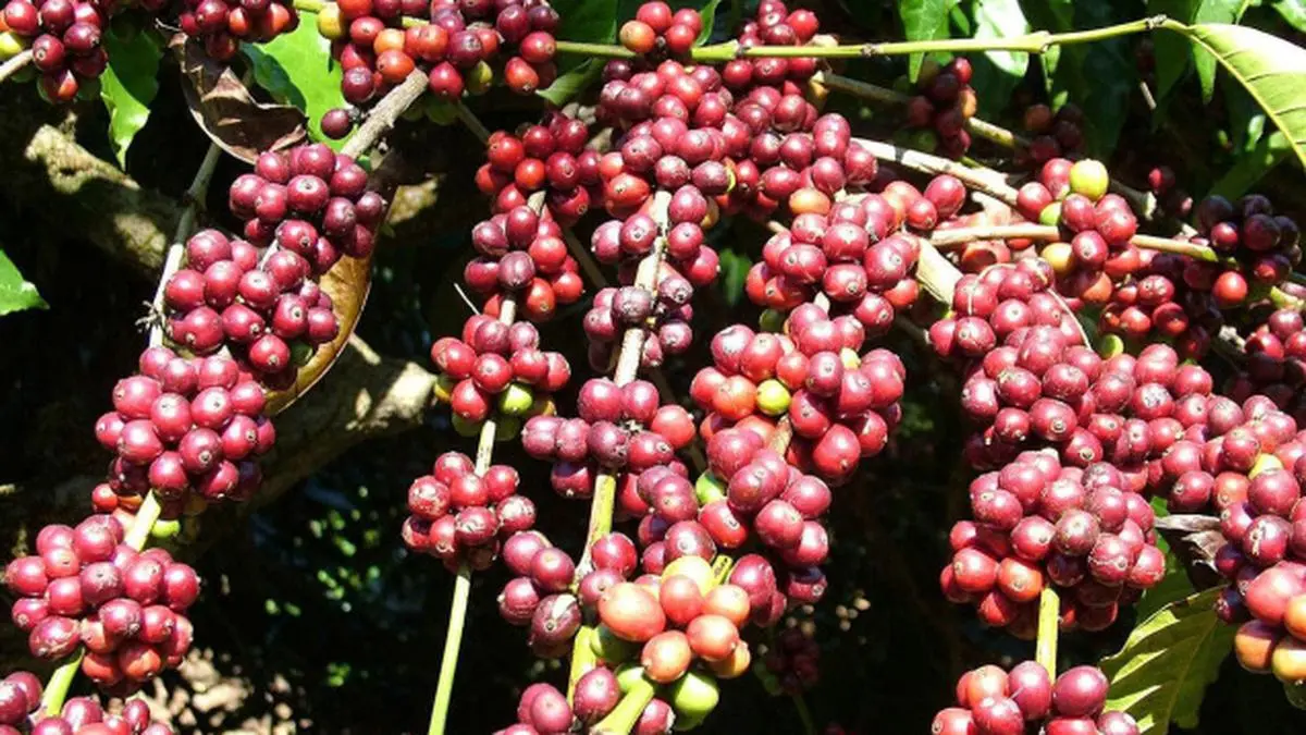
Plantation crop - A group of commercial crops of perennial nature, cultivated extensively in tropical and subtropical situations which need the employment of labour throughout the year and the produces of which are usually consumed after processing. Plantation crops are those which are cultivated on extensive scale like tea, coffee, Sugarcane and rubber. Plantation crop is also called as cash crops

Wheat" is "not a plantation crop" because plantation crops are usually grown for profits. Wheat is grown in a large scale of heaters worldwide. Wheat is used as a stable food and principle crop worldwide. 

Difference between Plantation Crops vs Fruit Crops

FeaturesPlantation CropsFruit Crops
Climate under which cultivatedTropical mainly between 20 degree N and 20 degree S LatitudeTropics, Subtropics and temperate.
Necessity of training and pruningLessMore
Suitability for ConsumptionProcessed and ConsumedMajor portion is consumed directly in fresh form
Perishability of produceLess/not presihablePresihable
Export Potential/Foreign Excahnge earningsComparatively highSome portion of fruits and preserved products are exported
UsesDiversified i.e. in medicine, beverages and oilseeds etc.Used mostly as protective foods (Rich in vitamins and minerals.
<br>
2

In which one of the following countries co-operative farming was the most successful experiment?

  1. ((a))

    Russia

  2. ((b))

    Denmark

  3. ((c))

    India

  4. ((d))

    The Netherlands

Show Answer
Answer: ((b))

Denmark

Co-operative Farming

  • A group of farmers forms a cooperative society by pooling in their resources voluntarily for more efficient and profitable farming.
  • Individual farms remain intact and farming is a matter of cooperative initiative.
  • Co-operative societies help farmers, to procure all important inputs of farming, sell the products at the most favourable terms and help in the processing of quality products at cheaper rates.
  • The co-operative movement originated over a century ago and has been successful in many western European countries like Denmark, Netherlands, Belgium, Sweden, Italy etc.
  • In Denmark, the movement has been so successful that practically every farmer is a member of a co-operative.

Additional Information

Collective Farming

  • The basic principle behind this types of farming is based on social ownership of the means of production and collective labour.
  • Collective farming or the model of Kolkhoz was introduced in the erstwhile Soviet Union to improve upon the inefficiency of the previous methods of agriculture and to boost agricultural production for self-sufficiency.
  • The farmers used to pool in all their resources like land, livestock and labour. However, they were allowed to retain very small plots to grow crops in order to meet their daily requirements.
3

Growing of flowers is called:

  1. ((a))

    Truck farming

  2. ((b))

    Mixed farming

  3. ((c))

    Factory farming

  4. ((d))

    Floriculture

Show Answer
Answer: ((d))

Floriculture

Floriculture, or flower farming, is a discipline of horticulture concerned with the cultivation of flowering and ornamental plants for gardens and for floristry, comprising the floral industry. The development, via plant breeding, of new varieties is a major occupation of floriculturists.

Extra Info-

The regions where farmers specialize in vegetables only, farming is known as truck farming. The distance of truck farms from the market is governed by the distance that a truck can cover overnight, hence the name truck farming.

Mixed Farming- This type of agricultural system is found in the highly developed parts of the world: north-western Europe, eastern North America, Russia, Ukraine, and the temperate latitudes of parts of the southern continents. Farming is very intensive and sometimes highly specialised. Traditionally, farmers have practiced a mixed economy by raising animals and growing crops on the same farm.

Factory farming is an unsustainable method of raising food animals that concentrates large numbers of animals into confined spaces. Factory farms are not compatible with a safe and wholesome food supply. It's time to ban factory farms.

4

Which one of the following types of cultivation was developed by European colonists?

  1. ((a))

    Kolkoz

  2. ((b))

    Mixed farming

  3. ((c))

    Viticulture

  4. ((d))

    Plantation

Show Answer
Answer: ((d))

Plantation

Plantation Agriculture

  • Plantation agriculture as mentioned above was introduced by the Europeans in colonies situated in the tropics.
  • Some of the important plantation crops are tea, coffee, cocoa, rubber, cotton, oil palm, sugarcane, bananas and pineapples.
  • The characteristic features of this type of farming are large estates or plantations, large capital investment, managerial and technical support, scientific methods of cultivation, single crop specialisation, cheap labour, and a good system of transportation that links the estates to the factories and markets for the export of the products.
  • The French established cocoa and coffee plantations in west Africa.
  • The British set up large tea gardens in India and Sri Lanka, rubber plantations in Malaysia and sugarcane and banana plantations in West Indies.
  • Spanish and Americans invested heavily in coconut and sugarcane plantations in the Philippines.
  • The Dutch once had a monopoly over sugarcane plantation in Indonesia. Some coffee fazendas (large plantations) in Brazil are still managed by Europeans.
  • Today, ownership of the majority of plantations has passed into the hands of the government or the nationals of the countries concerned

  • Collective farming or the model of Kolkhoz was introduced in the erstwhile Soviet Union to improve upon the inefficiency of the previous methods of agriculture and to boost agricultural production for self-sufficiency.
  • The farmers used to pool in all their resources like land, livestock and labour. However, they were allowed to retain very small plots to grow crops in order to meet their daily requirements.
  • Viticulture or grape cultivation is a speciality of the Mediterranean region. Best quality wines in the world with distinctive flavours are produced from high-quality grapes in various countries of this region. The inferior grapes are dried into raisins and currants. This region also produces olives and figs.
  • The advantage of Mediterranean agriculture is that more valuable crops such as fruits and vegetables are grown in winters when there is a great demand in European and North American markets.
  • Mixed Farming- This form of agriculture is found in the highly developed parts of the world, e.g. North-western Europe, Eastern North America, parts of Eurasia and the temperate latitudes of Southern continents. Mixed farms are moderate in size and usually, the crops associated with them are wheat, barley, oats, rye, maize, fodder and root crops. Fodder crops are an important component of mixed farming.
  • Crop rotation and intercropping play an important role in maintaining soil fertility. Equal emphasis is laid on crop cultivation and animal husbandry. Animals like cattle, sheep, pigs and poultry provide the main income along with crops.
  • Mixed farming is characterised by high capital expenditure on farm machinery and building, extensive use of chemical fertilisers and green manures and also by the skill and expertise of the farmers.
5

In which one of the following regions is extensive commercial grain cultivation not practiced?

  1. ((a))

    American Canadian prairies

  2. ((b))

    European Steppes

  3. ((c))

    Pampas of Argentina

  4. ((d))

    Amazon Basin

Show Answer
Answer: ((d))

Amazon Basin

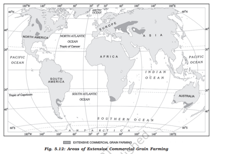
Extensive Commercial Grain Cultivation

  • Commercial grain cultivation is practiced in the interior parts of semi-arid lands of the midlatitudes.
  • Wheat is the principal crop, though other crops like corn, barley, oats, and rye are also grown. The size of the farm is very large, therefore entire operations of cultivation from plowing to harvesting are mechanized.
  • There is a low yield per acre but a high yield per person.
  • This type of agriculture is best developed in Eurasian steppes, the Canadian and American Prairies, the Pampas of Argentina, the Velds of South Africa, the Australian Downs, and the Canterbury Plains of New Zealand.

Hence, it is clear from the above points that extensive commercial grain cultivation is not practiced in Amazon Basin.

The gathering is practiced in:

  1. High latitude zones which include northern Canada, northern Eurasia, and southern Chile;
  2. Low latitude zones such as the Amazon Basin, tropical Africa, Northern fringe of Australia, and the interior parts of Southeast Asia
6

In which of the following types of agriculture is the farming of citrus fruit very important?

  1. ((a))

    Market gardening

  2. ((b))

    Plantation agriculture

  3. ((c))

    Mediterranean agriculture

  4. ((d))

    Co-operative farming

Show Answer
Answer: ((c))

Mediterranean agriculture

Mediterranean Agriculture

  • Mediterranean agriculture is highly specialised commercial agriculture.
  • It is practised in the countries on either side of the Mediterranean sea in Europe and in north Africa from Tunisia to Atlantic coast, southern California, central Chile, south western parts of South Africa and south and south western parts of Australia.
  • This region is an important supplier of citrus fruits.
  • Viticulture or grape cultivation is a speciality of the Mediterranean region. Best quality wines in the world with distinctive flavours are produced from high quality grapes in various countries of this region. The inferior grapes are dried into raisins and currants. This region also produces olives and figs.
  • The advantage of Mediterranean agriculture is that more valuable crops such as fruits and vegetables are grown in winters when there is great demand in European and North American markets.

Co-operative Farming

  • A group of farmers forms a co-operative society by pooling in their resources voluntarily for more efficient and profitable farming. Individual farms remain intact and farming is a matter of cooperative initiative.
  • Co-operative societies help farmers, to procure all important inputs of farming, sell the products at the most favourable terms and help in the processing of quality products at cheaper rates.
  • The co-operative movement originated over a century ago and has been successful in many western European countries like Denmark, Netherlands, Belgium, Sweden, Italy etc.

Plantation Agriculture

  • Plantation agriculture as mentioned above was introduced by the Europeans in colonies situated in the tropics.
  • Some of the important plantation crops are tea, coffee, cocoa, rubber, cotton, oil palm, sugarcane, bananas and pineapples.
  • The characteristic features of this type of farming are large estates or plantations, large capital investment, managerial and technical support, scientific methods of cultivation, single crop specialisation, cheap labour, and a good system of transportation which links the estates to the factories and markets for the export of the products.

Market Gardening 

  • Market gardening and horticulture specialise in the cultivation of high value crops such as vegetables, fruits and flowers, solely for the urban markets.
  • Farms are small and are located where there are good transportation links with the urban centre where high income group of consumers is located. It is both labour and capital intensive and lays emphasis on the use of irrigation, HYV seeds, fertilisers, insecticides, greenhouses and artificial heating in colder regions
7

Which one type of agriculture amongst the following is also called ‘slash and burn agriculture’?

  1. ((a))

    Extensive subsistence agriculture

  2. ((b))

    Primitive subsistence agriculture

  3. ((c))

    Extensive commercial grain cultivation

  4. ((d))

    Mixed farming

Show Answer
Answer: ((b))

Primitive subsistence agriculture

The correct answer is Primitive subsistence agriculture.

  • Slash and burn agriculture is a type of primitive subsistence agriculture.
  • it is also called Jhum agriculture.
  • It is a shifting cultivation practice.
  • It is also known as fire-fallow cultivation.

Key Points

  • Salient features of shifting agriculture -
  • Forest land is cleaned and ashes are added to the soil.
  • cultivated spots/areas are usually small.
  • Short periods of crop occupation alternate with long fallow periods.
  • Field rotation is practised instead of crop rotation.

Additional Information

  • Extensive subsistence agriculture is a technique where a vast expanse of land is cultivated to yield minimal output for primary consumption.
  • Mixed farming is a type of farming that involves both the growth of crops and the raising of life to the class.
  • Extensive Commercial Grain cultivation is an extensive and mechanized form of agriculture.
  • It specializes in a single crop.
  • The farms are very large.
  • Low yield per acre but high yield per person.

Note: Other types of farming have been explained here:

Primitive subsistence agricultureIt is the oldest form of farming, practised on small plots of land with the help of primitive tools.
Commercial farmingIt refers to the farming for profit where crops are grown for sale in the market. Mainly t is grown in large farms.
Shifting cultivationIt refers to the farming in which farmer cultivates on a plot of land temporarily, and when finding the land infertile to grow due to soil exhaustion, they move on to another plot.
8

Which one of the following does not follow monoculture?

  1. ((a))

    Dairy farming

  2. ((b))

    Mixed farming

  3. ((c))

    Plantation agriculture

  4. ((d))

    Commercial grain farming

Show Answer
Answer: ((b))

Mixed farming

Monoculture is the agricultural practice of producing or growing a single crop, plant, or livestock species, variety, or breed in a field or farming system at a time.

Dairy Farming

  • Dairy is the most advanced and efficient type of rearing of milch animals. It is highly capital intensive.
  • Animal sheds, storage facilities for fodder, feeding and mulching machines add to the cost of dairy farming. Special emphasis is laid on cattle breeding, health care, and veterinary services It is highly labour intensive as it involves rigorous care in feeding and mulching.
  • There is no off-season during the year as in the case of crop raising.
  • It is practiced mainly near urban and industrial centers which provide a neighborhood market for fresh milk and dairy products.
  • The development of transportation, refrigeration, pasteurization and other preservation processes have increased the duration of storage of various dairy products.

Plantation Agriculture

  • Plantation agriculture as mentioned above was introduced by the Europeans in colonies situated in the tropics.
  • Some of the important plantation crops are tea, coffee, cocoa, rubber, cotton, oil palm, sugarcane, bananas, and pineapples.
  • The characteristic features of this type of farming are large estates or plantations, large capital investment, managerial and technical support, scientific methods of cultivation, single crop specialization, cheap labor, and a good system of transportation that links the estates to the factories and markets for the export of the products.

Extensive Commercial Grain Cultivation

  • Commercial grain cultivation is practiced in the interior parts of semi-arid lands of the midlatitudes.
  • Wheat is the principal crop, though other crops like corn, barley, oats, and rye are also grown.
  • The size of the farm is very large, therefore entire operations of cultivation from plowing to harvesting are mechanized.
  • There is a low yield per acre but a high yield per person.
  • This type of agriculture is best developed in Eurasian steppes, the Canadian and American Prairies, the Pampas of Argentina, the Velds of South Africa, the Australian Downs, and the Canterbury Plains of New Zealand.

Mixed Farming- This form of agriculture is found in the highly developed parts of the world, e.g. North-western Europe, Eastern North America, parts of Eurasia, and the temperate latitudes of Southern continents. Mixed farms are moderate in size and usually, the crops associated with them are wheat, barley, oats, rye, maize, fodder, and root crops. Fodder crops are an important component of mixed farming.

  • Crop rotation and intercropping play an important role in maintaining soil fertility. Equal emphasis is laid on crop cultivation and animal husbandry. Animals like cattle, sheep, pigs, and poultry provide the main income along with crops.
  • Mixed farming is characterized by high capital expenditure on farm machinery and building, extensive use of chemical fertilizers and green manures, and also the skill and expertise of the farmers.
  • Hence, it is clear from the above points that Mixed farming does not follow monoculture, it is growing more than one crop simultaneously.
9

Which one of the following is a tertiary activity?

  1. ((a))

    Farming

  2. ((b))

    Trading

  3. ((c))

    Weaving

  4. ((d))

    Hunting

Show Answer
Answer: ((b))

Trading

Economic activities are broadly grouped into primary, secondary, tertiary, quaternary, and quinary activities.

  • Tertiary activities consist of all service occupations.
  • Transport, communication, trade, health, education, and administration are important examples of tertiary activities.
  • It includes both production and exchange.
  • The production involves the ‘provision’ of services that are ‘consumed’.
  • The output is indirectly measured in terms of wages and salaries.
  • The exchange involves trade, transport, and communication facilities that are used to overcome distance.
  • Tertiary activities, therefore, involve the commercial output of services rather than the production of tangible goods.
  • They are not directly involved in the processing of physical raw materials.
  • Common examples are the work of a plumber, electrician, technician, launderer, barber, shopkeeper, driver, cashier, teacher, doctor, lawyer, and publisher, etc.
  • The main difference between secondary activities and tertiary activities is that the expertise provided by services relies more heavily on specialized skills, experience, and knowledge of the workers rather than on the production techniques, machinery, and factory processes.

Hence, we can conclude that tertiary activities are related to the service sector and Trading is a tertiary activity. Trade is essentially buying and selling of items produced elsewhere. All the services in wholesale and retail trading or commerce sire specifically intended for profit.

10

Which one of the following activities is NOT a secondary sector activity?

  1. ((a))

    Iron Smelting

  2. ((b))

    Catching fish

  3. ((c))

    Marketing garments

  4. ((d))

    Basket weaving

Show Answer
Answer: ((b))

Catching fish

The correct answer is Catching fish.

  • Catching fish or fishing forms part of economic activity in the sector.

Key Points

On the basis of the nature of the economic activity, the Indian economy is classified as

  • Primary - Activities are undertaken by directly using natural resources. eg.- agriculture, mining fishing, forestry
  • Secondary - Industries where finished products are made from natural materials produced in the primary sector.
  • Also called the industrial sector.
  • People engaged are called blue-collar workers.
  • Eg. - Cotton mills, industrial production, etc.
  • Tertiary Sector - Also called the service sector, activities in this sector itself do not produce any goods but aid in the development of primary and secondary sectors.
  • Jobs in this sector are called white-collar jobs., eg - transportation, insurance, finance, etc.
  • Quaternary Activities -
  • Specialized activities in the knowledge sector.
  • The intellectual aspect of the economy**.**
  • It enables entrepreneurs to innovate & improve the quality of services offered in the economy.
  • eg. - Elementary schools & university professors, doctor offices, accounting and brokerage firms, etc.
  • Quinary Activities - 
  • The sector of the economy where top-level decisions are made.
  • It includes a government that passes legislation.
  • Focus on operation, rearrangement & interpretation of new & existing ideas.
  • These are called gold collar professionals, officers, research scientists.
11

Which one of the following sectors provides most of the employment in Delhi, Mumbai, Chennai and Kolkata?

  1. ((a))

    Primary

  2. ((b))

    Secondary

  3. ((c))

    Quaternary

  4. ((d))

    Service

Show Answer
Answer: ((d))

Service

The correct answer is Service.

  • In cosmopolitan cities such as Delhi, Mumbai, Kolkata, major economic activity is contributed by the service sector.

Key Points

  • Primary - Activities are undertaken by directly using natural resources. eg.- agriculture, mining fishing, forestry
  • Secondary - Industries where finished products are made from natural materials produced in the primary sector.
  • Also called the industrial sector.
  • People engaged are called blue-collar workers.
  • Eg. - Cotton mills, industrial production, etc.
  • Tertiary Sector - Also called the service sector, activities in this sector itself do not produce any goods but aid in the development of primary and secondary sectors.
  • Jobs in this sector are called white-collar jobs., eg - transportation, insurance, finance, etc.
  • Quaternary Activities -
  • Specialized activities in the knowledge sector.
  • The intellectual aspect of the economy.
  • It enables entrepreneurs to innovate & improve the quality of services offered in the economy.
  • eg. - Elementary schools & university professors, doctor offices, accounting and brokerage firms, etc.


Additional Information

  • Pink Collar Worker - is one who is employed in a job that is traditionally considered to be a women's work.
  • It requires a comparatively lesser skill set.
  • eg. - Baby sitters, florists, daycare workers, nurses, etc.
  • Sunrise industry is a term used for industries that are just in its infant's face and shows promise of the rapid boom.
  • eg - AI, food processing industries, etc.
12

Jobs that involve high degrees and level of innovations are known as:

  1. ((a))

    Secondary activities

  2. ((b))

    Quaternary activities

  3. ((c))

    Quinary activities

  4. ((d))

    Primary activities

Show Answer
Answer: ((c))

Quinary activities

The correct answer is Quinary activities.

Key Points

  • Primary - Activities are undertaken by directly using natural resources. eg.- agriculture, mining fishing, forestry
  • Secondary - Industries where finished products are made from natural materials produced in the primary sector.
  • Also called the industrial sector.
  • People engaged are called blue-collar workers.
  • Eg. - Cotton mills, industrial production, etc.
  • Quaternary Activities -
  • Specialized activities in the knowledge sector.
  • The intellectual aspect of the economy.
  • It enables entrepreneurs to innovate & improve the quality of services offered in the economy.
  • eg. - Elementary schools & university professors, doctor offices, accounting and brokerage firms, etc.
  • Quinary Activities - 
  • The sector of the economy where top-level decisions are made.
  • It includes a government that passes legislation.
  • Focus on operation, rearrangement & interpretation of new & existing ideas.
  • These are called gold collar professionals, officers, research scientists.

Additional Information

  • There are 8 core industries in India that are used to calculate IIP - (Index of Industrial Production).
  • 8 core industries products include - Electricity, Steel, Refinery products, Crude Oil, Coal, Cement, Natural Gas & Fertilisers.
  • IIp is considered load indicators of monthly industrial performance.
13

Which one of the following activities is related to quaternary sector?

  1. ((a))

    Manufacturing computers

  2. ((b))

    University teaching

  3. ((c))

    Paper and Raw pulp production

  4. ((d))

    Printing books

Show Answer
Answer: ((b))

University teaching

The correct answer is University Teaching.

  • University teaching is a specialized activity and forms part of the knowledge sector of the economy i.e. the quaternary sector.

Key Points

  • On the basis of the nature of the economic activity, the Indian economy is classified as
  • Primary - Activities are undertaken by directly using natural resources. eg.- agriculture, mining fishing, forestry
  • Secondary - Industries where finished products are made from natural materials produced in the primary sector.
  • Also called the industrial sector.
  • People engaged are called blue-collar workers.
  • Eg. - Cotton mills, industrial production, etc.
  • Tertiary Sector - Also called the service sector, activities in this sector itself do not produce any goods but aid in the development of primary and secondary sectors.
  • Jobs in this sector are called white-collar jobs., eg - transportation, insurance, finance, etc.
  • Quaternary Activities -
  • Specialized activities in the knowledge sector.
  • The intellectual aspect of the economy.
  • It enables entrepreneurs to innovate & improve the quality of services offered in the economy.
  • eg. - Elementary schools & university professors, doctor offices, accounting and brokerage firms, etc.
  • Quinary Activities
  • The sector of the economy where top-level decisions are made.
  • It includes a government that passes legislation.
  • Focus on operation, rearrangement & interpretation of new & existing ideas.
  • These are called gold collar professionals, officers, research scientists.

Additional Information

  • University education in India is regulated by the University Grants Commission Act, 1956.
  • UGC is a statutory body under the Ministry of Education.
  • Objectives of UGC includes-
  • Coordinations, determination, and maintaining of standards of university education.
  • It recognizes universities in India and disburses funds for the same.
  • A new body HECI - Higher EducationCommission of India - will subsume functions of UGC and AICTE and would be the apex body to regulate affairs of higher education in India.
14

Which one out of the following South American nation is apart of OPEC?

  1. ((a))

    Brazil

  2. ((b))

    Venezuela

  3. ((c))

    Chile

  4. ((d))

    Peru

Show Answer
Answer: ((b))

Venezuela

The correct answer is Venezuela.

  • OPEC is a permanent intergovernmental organization, established in 1960.
  • Venezuela is a founding member of OPEC.

Key Points

  • The headquarters of OPEC  is in Vienna, Austria.
  • It was formed to coordinate and unify petroleum policies.
  • The founding members -
  • | 1 | Iran | | --- | --- | | 2 | Iraq | | 3 | Kuwait | | 4 | Saudi Arabia | | 5 | Venezuela |


  • Currently, the organization has 13 members.
15

The Trans continental Stuart Highway runs between

  1. ((a))

    Darwin and Melbourne

  2. ((b))

    Edmonton and Anchorage

  3. ((c))

    Vancouver and St’ John’s City

  4. ((d))

    Chengdu and Lhasa

Show Answer
Answer: ((a))

Darwin and Melbourne

The correct answer is Darwin and Melbourne.

  • Trans continental stuart highway connects Darwin (North Coast) and Melbourne via Tennant creak and Alice springs in Australia.
  • It is longest national highway in the world with total length of 2,720 km (1,690 mi).

Key Points

  • Edmonton and Anchorage are connected by Alaskan Highway.
  • Trans Canadian Highway links Vancouver in British Columbia and St. John's city in New Foundland.
  • It is third longest highway with total length of 8030kms.
  • Chengdu of Sichuan and Lhasa of Tibet are connected by Sichuan- Tibet highway.
  • It has total length of Stuart Highway is a major Australian highway. It runs from Darwin, in the Northern Territory, via Tennant Creek and Alice Springs, to Port Augusta in South Australia; a distance of 2,720 km (1,690 mi).
  • Trans Siberian Highway connects St. Petersberg to Vladivostok
  • Total length of this highway is approx 11,000 km.
  • It is second longest  highway of the world.
16

Which country has the highest density of railway network?

  1. ((a))

    Brazil

  2. ((b))

    Canada

  3. ((c))

    USA

  4. ((d))

    Russia

Show Answer
Answer: ((c))

USA

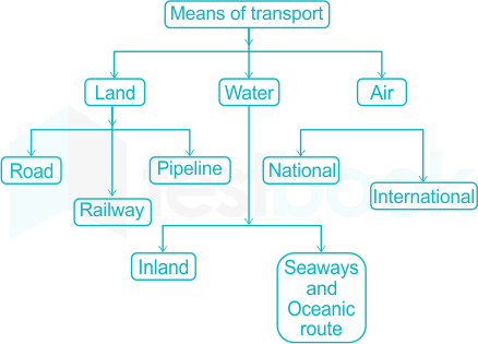
The use of transport and communication depends upon our need to move things from place of their availability to the place of their use. Human-beings use various methods to move goods, commodities, ideas from one place to another.

The following diagram shows the major means of transportation-

Railway Network

  • Indian railways network is one of the longest in the world. It facilitates the movement of both freight and passengers and contributes to the growth of economy.
  • Indian Railway was introduced in 1853, when a line was constructed from Bombay to Thane covering a distance of 34 km.
  • Indian Railways is the largest government undertaking in the country.
  • Its very large size puts lots of pressure on a centralised railway management system. Thus, in India, the railway system has been divided into sixteen zones. (As of  2017)

NOTE- According to Question the USA has the highest density of railway network.

According to the latest data, it's the Czech Republic which has the highest density of railway network.

17

The Big Trunk Route runs though

  1. ((a))

    The Mediterranean Indian Ocean

  2. ((b))

    The North Atlantic Ocean

  3. ((c))

    The South Atlantic Ocean

  4. ((d))

    The North Pacific Ocean

Show Answer
Answer: ((b))

The North Atlantic Ocean

The correct answer is The North Atlantic Ocean.

  • North Atlantic sea route is popularly known as a big trunk route.
  • It covers one-fourth of the World's foreign trade.
  • It covers the North-Eastern USA and North-Western Europe.

Key Points

  • The Mediterranean - Indian Ocean sea route connects Western European regions with West Africa, South Africa, South East Asia, and the commercial, agriculture, and livestock economics of Australia & Newzealand.
  • Suez Canal - Canal was constructed in 1869 between port said and port Suez in Egypt.
  • It bypassed the cape of the Hope route.
  • North Pacific sea route -
  • It links ports of the West Coast of North America with those of Asia.
  • South Pacific Sea route-
  • It connects Western Europe and North America with Australia, Newzealand, and scattered islands in the Pacific via the Panama canal.
  • This route is used for reaching Hong Kong & Philipines.
18

The Big Inch pipeline transports

  1. ((a))

    Milk

  2. ((b))

    Water

  3. ((c))

    LPG

  4. ((d))

    Petroleum

Show Answer
Answer: ((d))

Petroleum

The correct answer is Petroleum.

  • Big inch and small inch pipelines transport petroleum from Texas to New Jersey in the USA.
  • These were built as emergency measures in wake of WW2 and are collectively called inch pipelines.

Key Points

  • National Gas Grid project has been launched to create a network of pipeline infrastructure to connect gas sources to major demand centers in India.
  • Aims to develop a city gas distribution network.

Additional Information

  • Pradhanmantri Urja Yojna
  • Urja Ganga gas pipeline project aims to provide piped cooking gas to residents in Varanasi.
  • It will cater to 40 districts and 2600 villages.
  • It will help in reviving large fertilizer plants such as Sindri, Jharkhand.
  • At present 16,788 km of the natural gas pipeline is operational and 14,239 km is being developed.
19

Which one pair of the following places is linked by Channel Tunnel?

  1. ((a))

    London - Berlin

  2. ((b))

    Paris - London

  3. ((c))

    Berlin - Paris

  4. ((d))

    Barcelona - Berlin

Show Answer
Answer: ((b))

Paris - London

The correct answer is Paris - London.

  • Channel tunnel also called Eurotunnel or Channel links the United Kingdom with France.
  • This is beneath the English Channel at the Strait of Dover.
  • It is the only tunnel connecting the United Kingdom with mainland Europe.

Additional Information

  • India's first underwater rail tunnel will be launched in Kolkata.
  • it would be a 16.6 km long tunnel.
  • Seikan tunnel in Japan is the World's deepest railway tunnel.
20

Which one of the following continents has the maximum flow of global trade?

  1. ((a))

    Asia

  2. ((b))

    Europe

  3. ((c))

    North America

  4. ((d))

    Africa

Show Answer
Answer: ((a))

Asia

The correct answer is Asia.

  • Asia has a maximum flow of Global trade.

Key Points

  • Global trade has been an ancient feature since early civilizations such as Indus Valley Civilization, Mesopotamia, etc.
  • In modern times technological advancements along with the industrial revolution led to a rapid boom in the volume of global trade.

Additional Information

  • WTO or World Trade Organisation is the only global international organization dealing with rules of trade between nations.
  • WTO started functioning from 1st January 1995.
  • WTO evolved from General Agreement on Trade and Traffic signed in 1948 and negotiations in the Uruguay round (1984 - 86).
  • WTO has 164 members.
  • The ministerial conference, is held every two years in the highest decision-making body of WTO.
  • The Current Director-General of WTO is Ngozi Okonjo-Iweala.
  • 12th ministerial conference was proposed to be held in Nur Sultan, Kazakhastan, however in the wake up of the Covid-19 pandemic it has been delayed.
21

Who coined the phrase - "Give me the matter and I will build a world out of it"?

  1. ((a))

    Chamberlin

  2. ((b))

    James and Jefferys

  3. ((c))

    Kant

  4. ((d))

    Laplace

Show Answer
Answer: ((c))

Kant

The correct answer is Kant.

  • "Give me matter and I will build a world out of it" was quoted by Immanuel Kant.
  • Kant was a German Philosopher, who further developed Emanuel Swedenborg's nebular hypothesis in 1755.

Key Points

  • Nebular hypothesis most widely accepted theory that explains planetary formation.
  • It suggests that the Solar System formed from the gas and dust orbiting the Sun.
  • This theory by Kant was published in "Universal Natural History and Theory of Heavens"
  • Pierre Laplace gave a similar hypothesis in 1796 as his independent work.
  • A modern variant of Nebular hypothesis Solar Nebular Disk Model (SNDM) or accepted hypothesis.

Additional Information

  • Chamberlain along with Moulton gave the planetesimal hypothesis which proposed that a nearly passing star created tidal bulges on Sun and along with Solar prominences created planets.
  • James and Jeffreys gave the tidal hypothesis which was later rejected by H.N. Russell's observations.
22

The Binary Star Hypothesis about the origin of the earth was propounded by

  1. ((a))

    H. N. Russell

  2. ((b))

    R. A. Lyttelton

  3. ((c))

    O. Schimdt

  4. ((d))

    Von Weizsacker

Show Answer
Answer: ((a))

H. N. Russell

The correct answer is H.N. Russel.

  • The binary star hypothesis about the origin of Earth was given by Russel in 1937.
  • R.A. Lyttelton worked on and improved upon theory.

Key Points

  • The most widely accepted theory of planetary formation is the Nebular hypothesis of Immanuel Kant.
  • Pierre-Simon Laplace gave a similar theory in 1796.

Additional Information

  • Other theories for explaining the origin of planets
Tidal TheoryJames Jeans
Planetismal HypothesisChamberlin & Mouolton
Binary Star HypothesisH.N. Russel andrefined by Lyttleton.
Bond Structure ModelHannes Alfven
Interstellar Cloud TheoryOtto Schmidt
Protoplanet TheoryW.H. Macnea
Kupier's HypothesisKupier
Capture TheoryMichael Mark Woolfron
Modern Nebular HypothesisReviewed by A.J.R. Prentice, he based his theory on Laplacian Nebular Hypothesis.
23

Which one of the following has the largest number of satellites?

  1. ((a))

    Jupiter

  2. ((b))

    Neptune

  3. ((c))

    Saturn

  4. ((d))

    Uranus

Show Answer
Answer: ((c))

Saturn

The correct answer is Saturn.

  • 20 new moons of Saturn were discovered by Subaru telescope.
  • The total number of moons of Saturn is 124 - the highest in our solar system.
  • Titan is the largest moon of Saturn.

Key Points

  • Jupiter has the second-highest number of satellites - 92.
  • Ganymede is the largest satellite of Jupiter.
  • Europa, Io are other major moons.
  • Uranus is the third-largest planet in the Solar system.
  • Miranda, Ariel, Umbriel, Titania & Uberon are major moons.
24

The concept of ‘Base-Level’ was developed by:

  1. ((a))

    C.E. Dutton

  2. ((b))

    G.K. Gilbert

  3. ((c))

    J.W. Powell

  4. ((d))

    W.M. Davis

Show Answer
Answer: ((c))

J.W. Powell

The correct answer is J.W. Powell.

  • The concept of 'base - level' was given by Powell.
  • In the Geomorphology base level is the lower unit for an erosion process.
  • The term was given by Powell in 1875.

Key Points

  • W.M. Davis - father of Geomorphology gave a cycle of erosion using running water as an agent.
  • Davis used the concept of base-level as an end goal for the completion of cycles.
  • Eg. Mean sea level is the base level for the normal cycle of erosion.

Additional Information

  • Five cycles of erosion have been devised using five agents of erosion.
Normal CycleRunning water
Karst cycleUnderground water
Glacial cycleGlacier
Eolian cycleWind
Coastal cycleWaves
25

The theory of Isostasy was developed by:

  1. ((a))

    Dutton,C.E.

  2. ((b))

    Gilbert, G.K.

  3. ((c))

    Powell , J.W.

  4. ((d))

    Pratt

Show Answer
Answer: ((a))

Dutton,C.E.

The correct answer is Dutton, C.E.

Key Points

  • The theory of Isostasy explains the tendency of Earth's crust to attain equilibrium and distribution of the material in Earth's crust.
  • This theory is based on the opposing influence of buoyancy and gravity.
  • This was coined by C.E. Dutton in 1889.
  • It is utilized to explain how different topographic heights can exist on Earth's surface.
  • Their theory helps in explaining -
  • Mountain building.
  • Sedimentary basin formation.
  • The breakup of continents.
  • The formation of near ocean basins.
  • Factors that affect isostatic equilibrium.
  • Change in ice cover.
  • Endogenic forces.
  • eugenic forces.

Additional Information

  • Airy postulated that crustal material has uniform density but the topographical feature has varying depth up to which roots penetrate.
  • Pratt postulated that crustal material has varying density but uniform depth up to which roots penetrate.
  • J.W. Powell is credited for giving the concept of base-level.
26

The most important process in the glacial erosion is:

  1. ((a))

    Ablation

  2. ((b))

    Abrasion

  3. ((c))

    Frosting

  4. ((d))

    None of the above

Show Answer
Answer: ((b))

Abrasion

The correct answer is Abrasion​.

  • Abrasion: Glacial abrasion is the surface near achieved by individual clasts or rocks of various sizes contained within ice or subglacial sediments.

Key Points

  • Glaciers are primarily of two types:
  • Continental
  • Alpine
  • Erosional landforms:
  • Cirque / Corrie  
  • Hollow basin cut into a mountain ridge.
  • When it melts, the cirque may develop into a tarn lake.
  • Hanging Valley 
  • A valley carved out by small tributary glaciers that joins with the main valley.
  • Horn 
  • A Ridge that acquires a 'horn' shape when glacial activity cuts it from more than two sides.
  • Depositional landforms:
  • Morains - long ridges of deposits of glacial till.
  • Eskers - Melted snow and ice carries coarse boulders, rocks and appears as sinuous ridges.
  • Drumlin: Smooth oval-shaped ridges-like structure composed mainly of glacial till.

Additional Information

  • Ablation: It is defined as a combined process (such as substation, fusion, melting, evaporation) that removes snow or ice from the surface of a glacier or from a snowfield. Glaciers are formed in areas where the accumulation of snow exceeds its ablation.
  • Plucking occurs when rocks and stones become frozen to the base or sides or glacier are plucked from the ground as the glacier moves.
27

A sharp-edged glacially eroded ridge is known as:

  1. ((a))

    Arete

  2. ((b))

    Col

  3. ((c))

    Horn

  4. ((d))

    Roche-Moutonnee

Show Answer
Answer: ((a))

Arete

Explanation

The correct answer is Arete.

  • Sharp-edged glacially eroded ridge is called arete.
  • It is an erosional glacial landform.

Key Points

  • Important Erosional glacial landforms include -
  • Cirque / Corrie -  
  • Hollow basin cut into a mountain ridge.
  • When it melts, the cirque may develop into a tarn lake.
  • Hanging Valley
  • A valley carved out by small tributary glaciers that joins with the main valley.
  • Horn
  • A Ridge that acquires 'horn' shape when glacial activity cuts it from more than two sides.
28

Wind blowing from different directions in a desert forms:

  1. ((a))

    Barkhan

  2. ((b))

    Seif

  3. ((c))

    Star-like sand-dune

  4. ((d))

    Transverse sand-dune

Show Answer
Answer: ((c))

Star-like sand-dune

Deserts are areas that receive very little precipitation.

Deserts are found on every continent and cover about one-fifth of Earth’s land area. 

Geographically speaking, most deserts are found on the western sides of continents or—in the case of the Sahara, Arabian, and Gobi deserts and the smaller deserts of Asia—are located far from the coast in the Eurasian interior.

They tend to occur under the eastern sides of major subtropical high-pressure cells. These huge wheels of wind spiral clockwise in the Northern Hemisphere and counterclockwise in the Southern Hemisphere in the subtropics over the oceans; however, their behavior affects nearby continents.

Star-like sand-dune:

  • Star dunes are sand dunes that form in a sandy desert when the direction of the wind changes a lot.
  • These dunes have three or more “arms”, usually irregularly shaped.
  • They tend to accumulate in areas with multidirectional wind regimes.
  • Star dunes grow upward rather than laterally.
  • They dominate the Grand Erg Oriental of the Sahara.

Hence, option 3 is the correct answer.

Types Of DunesCharacteristics
Barkhan- A barchan or barkhan dune is a crescent-shaped dune. - It is a U-shaped type of sand dune that consists of horns or tips that point downwind or against the wind. - Sand supply is abundant where barchans occur along with hard ground and a constant wind direction. - Barkhan dunes can be formed when there are large amounts of sand in the desert and the availability of a steady wind blowing from one direction. - The Sahara and Gobi deserts in Africa and Asia respectively are the most notable places where barkhan dunes can be found.
Seif- Seif, a long, narrow sand dune or chain of dunes, generally oriented in a direction parallel to the prevailing wind or in a direction resulting from two or more winds blowing at acute angles to each other.
Transverse sand-dune- Transverse sand-dune- A large, strongly asymmetrical, elongated dune lying at right angles to the prevailing wind direction. - Transverse dunes have a gently sloping windward side and a steeply sloping leeward side. - They generally form in areas of sparse vegetation and abundant sand. - They are made by winds carrying lots of sand. The ridges lie at right angles to the direction of the wind.
29

Which one of the following is NOT correctly matched?

  1. ((a))

    Barkhan - Wind action

  2. ((b))

    Berg schrund - Glaciers

  3. ((c))

    Cataract - River

  4. ((d))

    Tombolo - Underground water

Show Answer
Answer: ((d))

Tombolo - Underground water

LandformsFeatures
Barkhan- A barchan or barkhan dune is a crescent-shaped dune. - Barkhan dunes can be formed when there are large amounts of sand in the desert and the availability of a steady wind blowing from one direction. - The Sahara and Gobi deserts in Africa and Asia respectively are the most notable places where barkhan dunes can be found.
Bergschrund- A bergschrund is a special type of crevasse. Bergschrunds are cracks that appear between the moving ice of a glacier and the non-moving, or stagnant, ice of a mountain or cliff.
Cataracts- The cataracts are sections where the river tumbles over rocks and have long kept boats from going up and down the river from Equatorial Africa to Egypt. - The cataracts are also significant because these define river segments where granites and other hard rocks come down to the edge of the Nile.
Tombolo- A tombolo is a spit connecting an island to the mainland. An example of a tombolo is Chesil Beach, which connects the Isle of Portland to the mainland of the Dorset coast.
30

A lake in the course of a river is known as a :

  1. ((a))

    Depositional lake

  2. ((b))

    Erosional lake

  3. ((c))

    Seasonal lake

  4. ((d))

    Transient lake

Show Answer
Answer: ((a))

Depositional lake

The correct answer is the Depositional lake.

  • The lakes formed in course of rivers are called a depositional lake.

Key Points

  • Lakes are formed due to erosion include Karst lakes and wind deflated lakes. 
  • Karst lakes are formed due to the solvent action of rainfall on limestone topography.
  • Wind in deserts creates hollows, sometime they reach groundwater level, which in turn seeps out farming small lakes. eg. - Utah in the USA.

Additional Information

  • Lakes found by Volcanic activity -
  • Crater and Caldera lakes are formed due to volcanic activity.
  • During an explosion top of the core may be blown leaving behind a natural hollow called crater.
  • Enlarged crater forms Caldera. eg. - Lonar lake in Maharashtra and Krakatao lake in Indonesia.
31

Which one of the following is not the characteristic of ocean bodies?

  1. ((a))

    Greater evaporation

  2. ((b))

    Mobility and mixing of temperature

  3. ((c))

    Lower specific heat

  4. ((d))

    Transparency

Show Answer
Answer: ((c))

Lower specific heat

The correct answer is a lower specific heat.

  • Ocean water bodies have high specific heat.
  • Large area, covering approx 717 of total surface area, leads to higher evaporation.
  • Oceanic currents & planetary circulations lead to mobility and moving of temperature.

Key Points

  • Specific heat is defined as the amount of heat unit mass required to raise the temperature by one degree celsius.
  • Si unit of specific heat in J / KgK.
  • The specific heat of water is 4182 J /KgK.
32

The rate of change of pressure per unit distance is known as

  1. ((a))

    Change of pressure

  2. ((b))

    Decrease in pressure

  3. ((c))

    Gradient of pressure

  4. ((d))

    Variation in pressure

Show Answer
Answer: ((c))

Gradient of pressure

The correct answer is a Gradient of pressure.

  • The rate of change of pressure per unit distance is called the pressure gradient.

Key Points

  • Force produced due to pressure gradient is called the pressure gradient force.
  • It influences the winds 
  • Direction and
  • Magnitude
  • Other forces that influence the winds include 
  • Coriolis force - affects the wind direction only.
  • Frictional force - affects both direction & magnitude of winds.

Additional Information

  • The adjective or horizontal movement of air is called wind.
  • Wind always flows from high pressure to low pressure.
  • Under influence of the Coriolis effect
  • The wind is deflected towards the right in the Northern hemisphere.
  • The Wind is deflected towards the left in the Southern hemisphere.
33

Which one of the following is not correctly matched?

  1. ((a))

    Purga - Siberia

  2. ((b))

    Bora - Adriatic coast

  3. ((c))

    Mistral - France

  4. ((d))

    Samoo - Egypt

Show Answer
Answer: ((d))

Samoo - Egypt

The correct answer is Samoo - Egypt.

  • Samoo is a hot and dry wind blowing in the Kurdistan region of Iran and Iraq.
  • Samoo has characteristics similar to Foehn of Central Europe.

Key Points

Wind TypeConditionArea
Chinook (Snow eaters)Hot & DryRockies (North America)
FoehnHot & DryThe Alps, Europe
Brick FielderHot & DryAustralia
SiroccoHot & MoistSahara to the Mediterranean sea
SolanoHot & moist windSahara to Lebneian peninsula
Harmattan (Doctor wind)Hot & DryWest Africa
BoraCold, DryHungary to Northern Italy
MistralColdAlps & France
BlizardColdTundra
PurgaColdRussia
NorwesterHotNewzealand
Santa AnaHotCalifornia
Karaburun (Black Storm)Hot & DustyCentral Asia
ElephantaMoist wind in MonsonMalabar coast
LooA hot and dry windBlowing in Northern India from Northwest & West to East.
PamperoCold & Polar windsBlowing in the Pampas region in South America.
ZondaWarm windsBlowing in Argentina & Uruguay.


Additional Information

  • Three major wind include-
  • Local wind - Absolute local characteristic.
  • Regional wind - Spatial influence is of a larger extent than monsoon wind.
  • Planetary winds - Global expanse and prevalent throughout the year, ex - Easterlies, Westerlies, etc.
34

Which one of the following local winds is not correctly matched?

  1. ((a))

    Foehn - Central Europe

  2. ((b))

    Chinook - Rockies

  3. ((c))

    Khamsin - Nigeria

  4. ((d))

    Brick-fielder - Australia

Show Answer
Answer: ((c))

Khamsin - Nigeria

The correct answer is Khamsin-Nigeria.

  • Khamsin is a hot and dry wind of Egypt.
  • It is a local wind having absolute regional characteristics.

Key Points

Important local wind include -

Chinook (Snow eaters)Hot & DryRockies (North America)
FoehnHot & DryThe Alps, Europe
Brick FielderHot & DryAustralia
SiroccoHot & MoistSahara to the Mediterranean sea
SolanoHot & moist windSahara to Lebneian peninsula
Harmattan (Doctor wind)Hot & DryWest Africa
BoraCold, DryHungary to Northern Italy
MistractColdAlps & France
BlizardcoldTundra
PurgaColdRussia
NorwesterHotNewzee Land
Santa AnaHotCalifornia
Karaburun (Black Storm)Hot & DustyCentral Asia
ElephantaMoist wind in MonsonMalabar coast


Additional Information 

  • Three major wind include-
  • Local wind - Absolute local characteristic.
  • Regional wind - Spatial influence is of a larger extent than monsoon wind.
  • Planetary winds - Global expanse and prevalent throughout the year, ex - Easterlies, Westerlies, etc.
35

Which one of the following clouds is an indicative of clear and dry weather?

  1. ((a))

    Altostratus

  2. ((b))

    Cirrus

  3. ((c))

    Nimbus

  4. ((d))

    Nimbo-Cumulous

Show Answer
Answer: ((b))

Cirrus

Cloud is a mass of minute water droplets or tiny crystals of ice formed by the condensation of the water vapour in free air at considerable elevations. As the clouds are formed at some height over the surface of the earth, they take various shapes. According to their height, expanse, density and transparency or opaqueness clouds are grouped under four types : (i) cirrus; (ii) cumulus; (iii) stratus; (iv) nimbus

Cirrus Cloud:

  • Cirrus clouds are formed at high altitudes (8,000 - 12,000m).
  • They are thin and detached clouds having a feathery appearance.
  • They are always white in colour.
  • Cirrus clouds usually signal clear, fair weather.
  • Hence, option 2 is the correct answer.

Additional Information

Types Of CloudsFeatures
Stratus- As their name implies, these are layered clouds covering large portions of the sky. - These clouds are generally formed either due to loss of heat or the mixing of air masses with different temperatures - Altostratus clouds are mid-level, grey or blue-grey clouds that usually cover the whole sky.
Nimbus- Nimbus clouds are black or dark grey. - They form at middle levels or very near to the surface of the earth. - These are extremely dense and opaque to the rays of the sun. Sometimes, the clouds are so low that they seem to touch the ground. - Nimbus clouds are shapeless masses of thick vapour.
Nimbo-Cumulous- Cumulonimbus clouds are the “thunderheads” that can be seen on a warm summer day and can bring strong winds, hail, and rain. - Many cumulonimbus clouds occur along cold fronts, where cool air is forced under warm air. - They usually shrink as evening approaches, and moisture in the air evaporates. Cumulonimbus clouds gradually become stratocumulus clouds, which rarely produce rain.
36

Which one of the following clouds create more problems for the pilots of aeroplane:

  1. ((a))

    Cirrus

  2. ((b))

    Cumulous

  3. ((c))

    Nimbus

  4. ((d))

    Stratus

Show Answer
Answer: ((b))

Cumulous

Cloud is a mass of minute water droplets or tiny crystals of ice formed by the condensation of the water vapour in free air at considerable elevations. As the clouds are formed at some height over the surface of the earth, they take various shapes. According to their height, expanse, density and transparency or opaqueness clouds are grouped under four types : (i) cirrus; (ii) cumulus; (iii) stratus; (iv) nimbus

Types Of CloudsFeatures
Stratus- As their name implies, these are layered clouds covering large portions of the sky. - These clouds are generally formed either due to loss of heat or the mixing of air masses with different temperatures
Cirrus- Cirrus clouds are formed at high altitudes (8,000 - 12,000m). - They are thin and detached clouds having a feathery appearance. They are always white in colour.
Nimbus- Nimbus clouds are black or dark grey. - They form at middle levels or very near to the surface of the earth. - These are extremely dense and opaque to the rays of the sun. Sometimes, the clouds are so low that they seem to touch the ground. - Nimbus clouds are shapeless masses of thick vapour.
Cumulous- Cumulus clouds look like cotton wool. - They are generally formed at a height of 4,000 - 7,000 m. They exist in patches and can be seen scattered here and there. They have a flat base. - They are known to be extremely dangerous to air traffic, and it is recommended to avoid them as much as possible. They can be extremely insidious, and an inattentive pilot can end up in a very dangerous situation while flying in apparently very calm air.
37

The average annual rainfall recorded on the earth is about:

  1. ((a))

    50 cm

  2. ((b))

    75 cm

  3. ((c))

    100 cm

  4. ((d))

    125 cm

Show Answer
Answer: ((c))

100 cm

The correct answer is 100 cm.

  • The average annual rainfall recorded on the earth is about 100 cm.

Key Points

  • Rainfall distribution is highly uneven.
  • The highest rainfall is recorded from Mawsynram in the world.
  • The average recorded rainfall in Mawsynram is 11,872mm.
  • Poles on the other hand do not receive any rainfall at all.

Additional Information

  • The average annual rainfall of India is 119 cm.
  • Mawsynram in India receives the highest annual rainfall.
  • As per records Jaisalmer, Rajasthan in India is the driest place.
38

Tornadoes are more frequent in the

  1. ((a))

    Caribbean Sea

  2. ((b))

    North East USA

  3. ((c))

    North West USA

  4. ((d))

    South East USA

Show Answer
Answer: ((d))

South East USA

The correct answer is South East USA.

  • Tornados are more frequent in South East USA.
  • Tornados are also known by neam of twisters.
  • It is a violently rotating column of air over land associated with severe thunderstorms.
  • These are usually a downward spiral stemming from a cumulonimbus cloud and are accompanied by rains, hail or sleet.

Key Points

  • Tornados occur exclusively over land.
  • They have extensive updraught near their center.
  • Condition for formation -
  • Warm & humid conditions in the lower atmosphere and cooler than usual conditions in the upper atmosphere.
  • Wind sheer - i.e. change in wind direction and increase in wind speed with height.
  • Tornados are most common in spring.
  • Tornados are measured by the Enhanced Fujita Scale.

Additional Information

  • Cyclones are rapid inward air circulation around a low-pressure area.
  • The air circulates in an anti-clockwise direction in the Nothern hemisphere.
  • The air circulates in a clockwise direction in the Southern hemisphere.
  • There are two types of cyclones - 
  • Tropical cyclone
  • Extra-tropical cyclone - also known as temperate cyclone, frontal cyclone, Wave cyclones, or Midlatitude cyclones.
39

The Koppen’s classification of climate "BWh" stands for:

  1. ((a))

    Cold mid-latitude deserts

  2. ((b))

    Hot low-latitude desert

  3. ((c))

    Monsoon climate

  4. ((d))

    Savanna grasslands

Show Answer
Answer: ((b))

Hot low-latitude desert

The correct answer is Hot low-latitude desert.

  • Desert is defined as a climatic condition where evaporation loss is more than precipitation gas.
  • BWh climate type is situated at subtropical left margins of continents.

Key Points

  • Temperature and precipitation are taken into account while doing Koppen's classification.
  • The five main climatic groups classified by Koppen with symbols are
Sr.no.Climatic Groups
1Tropical
2Dry
3Temperature
3Subpotar Taiga
5Polar


Additional Information

  • Cold mid-lattitude deserts - BSk
  • Monsoon climate  - Am
  • Savanna climate - Aw
40

Which one of the following are known as ‘thermal winds’?

  1. ((a))

    Ascending winds

  2. ((b))

    Jet streams

  3. ((c))

    Trade winds

  4. ((d))

    Westerlies

Show Answer
Answer: ((b))

Jet streams

The correct answer is Jet streams.

  • Thermal wind is the Vector difference between the geostrophic wind at upper altitudes minus that at lower altitudes in the atmosphere.
  • Thermal wind is a misnomer - it describes a change in wind height rather than the wind itself.

Key Points

  • Jet streams are high - speed winds that occur in narrow bands of air westerlies.
  • Jet streams are geostrophic wind blowing horizontally through the upper layers of the troposphere, generally from West to East.
  • Jet streams extend from 20 degrees latitude to the poles in both hemispheres.
  • Jet streams are part of upper-level westerlies.

Additional Information

  • Trade winds are permanent winds flowing from East to West.
  • It flows between 30°North and South of the equator.
  • Trade winds as North-Eastern trades in the Northern hemisphere.
  • Trade winds blow as South-Eastern trades in the Southern hemisphere.
  • Westerlies - These winds are developed between 30° - 60° North & South of the equator.
  • They are called roaring for his furious fifties and shrieking sixties in the Southern hemisphere.
  • They blow from South West in the Northern hemisphere and North West in the Southern hemisphere towards poles.
41

Which one of the following is not correctly matched?

  1. ((a))

    Fortworth - Texas

  2. ((b))

    Birmingham - Arkansa

  3. ((c))

    Atlanta - Georgia

  4. ((d))

    Sacramento - California

Show Answer
Answer: ((b))

Birmingham - Arkansa

The correct answer is Birmingham - Arkansa.

  • Birmingham is a city in Alabama state of the USA.
  • It is a major center for the iron and steel industry in the USA.

Key Points

  • Fortworth in Texas state of the USA is a booming industrial town.
  • Atlanta in Georgia state is a major financial town of the USA.
  • It is located at the foothills of the Appalachian mountains.
  • Sacramento is located in the state of California.
  • Sacramento is the inland capital of the state.

Additional Information

  • There are a total of 50 states in the USA.
  • Silicon Valley - Global center for technological innovations, is located in the state of California.
42

Which one of the following is known as the "electronic city" of USA?

  1. ((a))

    Phoenix

  2. ((b))

    Portland

  3. ((c))

    Salt Lake city

  4. ((d))

    Denver

Show Answer
Answer: ((a))

Phoenix

Electronic City is an information technology hub in Bangalore, India, located in Anekal taluk. It is one of India's largest electronic/IT industrial parks.

  • Phoenix is the capital and most populous city in Arizona.
  • It is also the fifth-most populous city in the United States and the largest state capital by population, and the only state capital with a population of more than one million residents.
  • Denver is the capital and most populous municipality of the U.S. state of Colorado. Denver is located in the South Platte River Valley on the western edge of the High Plains just east of the Front Range of the Rocky Mountains.
  • Salt Lake City, state capital and seat (1849) of Salt Lake county, north-central Utah, U.S., on the Jordan River at the southeastern end of Great Salt Lake.
  • Portland is the largest and most populous city in the U.S. state of Oregon and the seat of Multnomah County
43

Which one of the following is not a landlocked country?

  1. ((a))

    Czech Rep.

  2. ((b))

    Hungary

  3. ((c))

    Romania

  4. ((d))

    Slovakia

Show Answer
Answer: ((c))

Romania

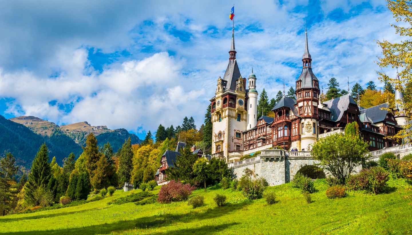
Romania is NOT a landlocked country.

  • Out of the options provided, Romania is not a landlocked country.
  • Czech Republic, Hungary as well as Slovakia are landlocked countries.

Key Points

  • Landlocked country:
  • A landlocked nation is a sovereign state surrounded by land, or whose coastlines are the only ones that lie on the closed seas.
  • There are 49 such countries at present, plus five partly recognized nations.

Important Points

  • Romania:
  • Romania is a country that is halfway between the North Pole and the equator in Eastern Europe.
  • Capital: Bucharest
  • Population: 19.71 million (2016)
  • Key Cities: Cluj-Napoca Cluj, Timisoara, Ias
  • Official Language: Romanian (official), Hungarian, German
  • Bordering Countries: Bulgaria, Serbia, Hungary, Ukraine, and Moldovia

Learn about the enthralling history, language and culture in Romania

Additional Information

  • Czech Republic:
  • Capital: Prague
  • Population: 10.5 million
  • Key Cities: Prague, Brno, Ostrava, Pilsen
  • Official Language: Czech
  • Bordering Countries: Austria, Germany, Poland, Slovakia
  • Slovakia:
  • Capital: Bratislava
  • Population: 5,400,000
  • Key Cities: Bratislava (capital), Presov, Kosice, Zilina, Martin, Poprad
  • Official Language: Slovak
  • Bordering Countries: Czech Republic, Poland, Ukraine, Hungary, Austria
  • Hungary:
  • Capital: Budapest
  • Population: 9,797,561
  • Key Cities: Debrecen, Miskolc, Szeged
  • Official Language: Hungarian
  • Bordering countries: Slovakia, Ukraine, Austria, Romania, Serbia, Croatia, and Slovenia
44

Which one of the following statements is not correct?

  1. ((a))

    Danube is the second longest river of Europe.

  2. ((b))

    Danube merges into the Black Sea through an estuary

  3. ((c))

    The Aegean Sea has about 1500 islands.

  4. ((d))

    About 10 per cent of the Aegean Islands are uninhabited.

Show Answer
Answer: ((d))

About 10 per cent of the Aegean Islands are uninhabited.

The correct answer is About 10 percent of the Aegean Islands are uninhabited.

  • The Greek islands include approximately 6,000 islands and islets scattered across the Aegean and Ionian Seas, of which only 227 are inhabited. Thus option 4 is incorrect.

Additional Information

  • Danube: 
  • The Danube is Europe's second-longest river, after the Volga.
  • It flows in Eastern and Central Europe.
  • The Danube was once the Roman Empire's long-standing border and flows through 10 countries today.
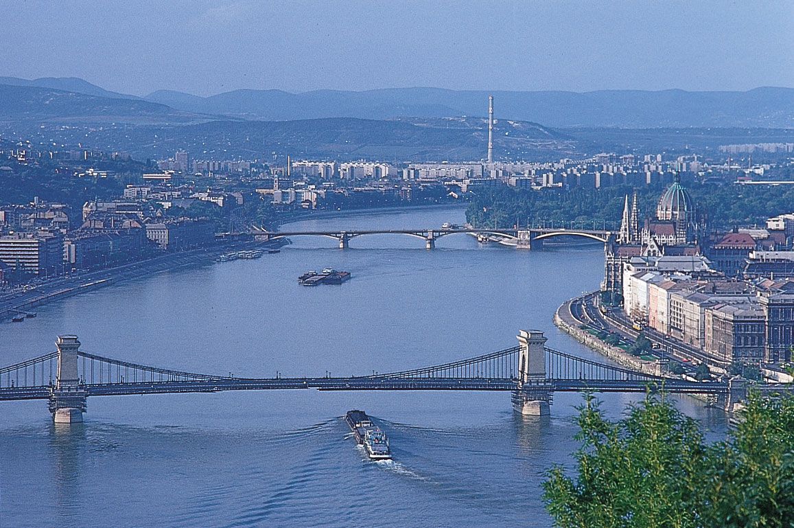
  • The Danube river originates in Germany and flows south-eastward for a distance of some 2,780 km until it empties into the Black Sea through the Danube delta in Romania.

Danube River | Location, Map, Countries, & Facts | Britannica

  • The Aegean Sea:
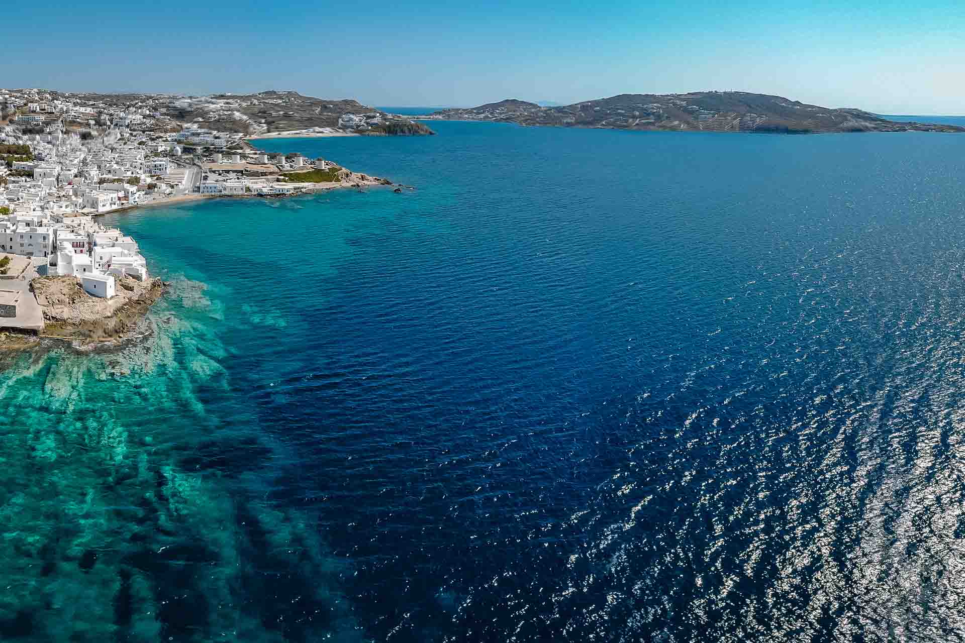
  • The Aegean Sea comprises more than 1,400 islands, big and small.
  • The bulk of the island chains belong to Greece, with Turkey being only able to claim as part of its territory a limited number of islands.
  • There are seven groups of islands: the Northeast Aegean, Sporades, Euboea, ArgoSaronic, Cyclades, Southern Sporades (Dodecanese), and Crete, beginning in the north and approximately going counter-clockwise.
  • The Aegean Sea was known as the Archipelago, or Chief Sea, in earlier times.
  • The word, however, has won the present meaning of groups of islands because of its many islands.

The Fascinating History of the Aegean Sea | ELITE ESTATES

45

Which one of the following is the most busy navigable river?

  1. ((a))

    Danube

  2. ((b))

    Rhine

  3. ((c))

    Thames

  4. ((d))

    Volga

Show Answer
Answer: ((b))

Rhine

The correct answer is the Rhine.

  • The Rhine is the most important and busiest waterway in Europe.

Key Points

  • Navigable rivers:
  • Rivers that are deep, wide, perennial, and free of any obstruction are known as navigable rivers.
  • In navigable rivers, boats can move heavy goods from one location to another and transport them.

Important Points

  • The Rhine waterways are significant in the following ways:
  • With more than 20,000 ocean-going ships and 2,00,000 inland vessels exchanging their cargo on this route, it is the world's most widely used waterway.
  • This stretch of the waterway is pushed by immense tonnage.
  • From Rotterdam in the Netherlands to Basel in Switzerland, the Rhine river is navigable for 700 km.
  • It flows through a rich coalfield that has made the entire region a prosperous area of development.
  • The waterway connects the industrial zones of **Germany, France, Switzerland, Belgium, the Netherlands with North Atlantic sea routes.**​

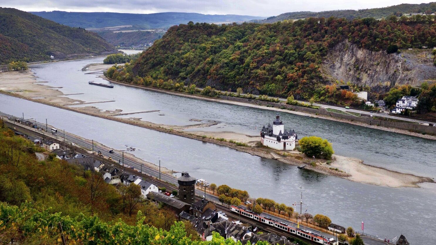
Rhine river of Europe   

Drought has hit Europe's Rhine River and its commerce hard: 'Everyone's  hoping for rain' - Los Angeles Times


Additional Information

  • Ganga and Brahmaputra are two navigable rivers in India.
  • Other busy waterways include the French Seine and Loire Rivers, the Eastern European Danube River, and Russia's Volga River.
46

The Filipinos originally belong to:

  1. ((a))

    Chinese

  2. ((b))

    Indonesians

  3. ((c))

    Malays

  4. ((d))

    Micronesians

Show Answer
Answer: ((c))

Malays

The correct answer is Malays.

  • The Filipinos originally belonged to the ethnic group of 'Malays'.

Important Points

  • Filipinos are the inhabitants of the nation of the Philippines who are native to or residents of the nation.
  • In the pre-Hispanic past of the Philippines, Malays played a significant role.
  • Malays have made a significant contribution to the history of the Philippines and inspired Filipinos' modern-day lifestyles.
  • Before Spanish rule, the Malay language was the archipelago's lingua franca.
  • There is no big majority or a minority of Ethnic Malays in the modern Philippines today (Filipinos classified as Ethnic Malays make up 2 percent of the total population)

Key Points

Filipinos

Filipinos - Wikipedia

47

The main resource of Japan is:

  1. ((a))

    Coal

  2. ((b))

    Human

  3. ((c))

    Iron

  4. ((d))

    Petroleum

Show Answer
Answer: ((b))

Human

The correct answer is Human.

  • The main resource in Japan is its Human capital.

Important Points

  • Countries such as Japan have invested in their human assets.
  • Japan does not have an abundance of natural resources like coal, petroleum, natural gas, and mineral ores.
  • The country majorly meets its requirement of natural resources through import.
  • Japan is a developed country today because it has invested in individuals, especially in the areas of education and health.
  • Such individuals have made good use of other tools, such as land and money.
  • Japan has been made rich / developed by efficiency and technology developed by people.

Additional Information

  • Capital of Japan: Tokyo
  • Currency: Japanese Yen
48

The annual fish catch of Japan in the world is about:

  1. ((a))

    10%

  2. ((b))

    12%

  3. ((c))

    14%

  4. ((d))

    16%

Show Answer
Answer: ((a))

10%

The correct answer is 10%.

  • The annual fish catch of Japan in the world is about 10%.

Important Points

  • Japan is among the largest consumers of marine products in the world.
  • It is the world's largest fish-eating country, consuming 7.5 billion tonnes of fish annually, or roughly 10% of the world's catch. This is the equivalent per person of 30 kilograms a year.
  • The Japanese eat so much fish that, with its enormous demand, Japan has historically dominated the world price of seafood.
  • Japan is home to a commercial fishing industry worth $14 billion.
  • Fish and several other sea creatures are captured, imported, and raised on aquafarms by local fishermen.

Additional Information

  • In Japan, there are about 200,000 fishing boats. Of these, about 2,000 are tuna fish and bonito fish.
  • In Japan, 66% of the fish eaten are captured domestically.
  • Traditionally, fish have been used to fertilize rice fields and today they symbolize the expectation of an abundant harvest.
  • Top 5 most caught fishes (millions of tons per year):
  • Alaska Pollack (4.5); Japanese Pilchard (4); Chilean Pilchard (3.25); Atlantic Cod (2.25); Chilean Jack Mackerel.
49

Which one of the following has the highest percentage of urban population?

  1. ((a))

    Oman

  2. ((b))

    Qatar

  3. ((c))

    Saudi Arabia

  4. ((d))

    Syria

Show Answer
Answer: ((b))

Qatar

The correct answer is Qatar.

  • Qatar has the highest percentage of urban population among the given countries.

Important Points

  • The urban population refers, as specified by national statistical offices, to individuals residing in urban areas.
  • It is estimated from the United Nations World Urbanization Prospects using World Bank population projections and urban ratios.
  • The urban population of Qatar increased from 88.4 % in 1970 to 99.2 % in 2019 growing at an average annual rate of 0.24%.
  • In 2018, its peak value over the past 58 years was 99.14%, while in 1960, its lowest value was 85.28%.

Additional Information

  • Qatar is situated in the Middle East and the Asian continent is home to the region.
  • Quick facts:
  • Population: roughly 2.8 million people
  • Capital City: Doha
  • Literacy: About 97% can read and write.
  • Religions: Islam is the official religion. There are mainly Muslims 68%, Christians 14%, Hindus 14%, Buddhists 3%
  • Currency: 1 Qatari Riyal = 100 fils
50

Which one of the following has the highest birth rate?

  1. ((a))

    Afghanistan

  2. ((b))

    Iran

  3. ((c))

    Oman

  4. ((d))

    Yeman

Show Answer
Answer: ((c))

Oman

The correct answer is Oman.

  • Oman has the highest birth rate among the given countries.

Important Points

  • The crude birth rate shows the number of live births per 1,000 population, measured at mid-year, occurring during the year.
  • In determining the rate of population growth, the birth rate is typically the dominant factor.
  • It depends on both the fertility level and the population's age structure.
  • The current birth rate for Oman in 2020 is 18.090 births per 1000 people, a 4.02% decline from 2019.
  • The birth rate of Oman fell gradually from 48.1 per 1,000 people in 1970 to 18.5 per 1,000 people in 2019.

Key Points

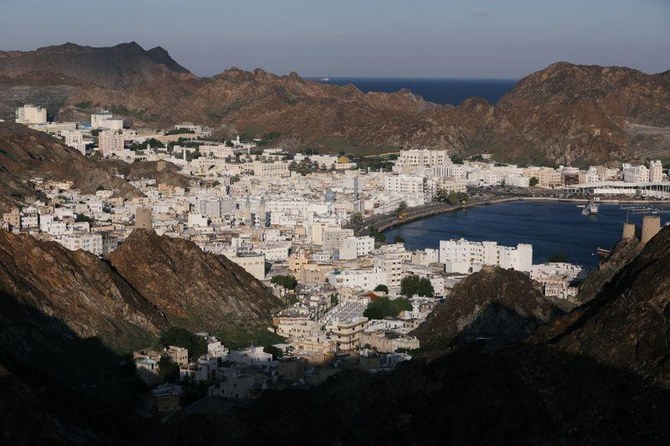
An aerial view of Oman              

Oman urges public firms to speed up replacing foreigners with citizens |  Arab News

Additional Information

  • Capital: Muscat
  • Currency: Omani Rial
51

Which one of the following states has the highest area under mustard?

  1. ((a))

    Haryana

  2. ((b))

    Punjab

  3. ((c))

    Rajasthan

  4. ((d))

    Uttar Pradesh

Show Answer
Answer: ((c))

Rajasthan

India has three cropping seasons — rabi, kharif and zaid.

  • Kharif crops are grown with the onset of monsoon in different parts of the country and these are harvested in September-October. Important crops grown during this season are paddy, maize, jowar, bajra, tur (arhar), moong, urad, cotton, jute, groundnut and soyabean.
  • Rabi crops are sown in winter from October to December and harvested in summer from April to June. Some of the important rabi crops are wheat, barley, peas, gram and mustard.
  • In between the rabi and the kharif seasons, there is a short season during the summer months known as the Zaid season. Some of the crops produced during ‘zaid’ are watermelon, muskmelon, cucumber.

NOTE- In Rajasthan state, the mustard crop is mostly cultivated in Alwar, Bharatpur, Jaipur, Dholpur, Sawaimadhopur, Sriganganagar, Jhunjhunu & Sikar districts. Bharatpur, eastern district of Rajasthan is the largest mustard growing division covering about 48 per cent of the total production of the state.

52

The highest per acre yield of mustard is found in:

  1. ((a))

    Gujarat

  2. ((b))

    Punjab

  3. ((c))

    Rajasthan

  4. ((d))

    Uttar Pradesh

Show Answer
Answer: ((a))

Gujarat

Crop yield is a measurement of the amount of agricultural production harvested—yield of a crop—per unit of land area.

Gujarat is set to witness bumper rape-mustard seed crop in 2013-14, revealed a survey conducted by the Solvent Extractors’ Association of India (SEA). According to the trade body, mustard seed output in the state to jump by 53 per cent on a year-on-year basis with a sharp increase in the yield.

Notably, the yield is expected to be highest in Gujarat at about 1,680 kg per hectare against the national average of 1065 kg per hectare.

NOTE- In Rajasthan state, the mustard crop is mostly cultivated in Alwar, Bharatpur, Jaipur, Dholpur, Sawaimadhopur, Sriganganagar, Jhunjhunu & Sikar districts. Bharatpur, eastern district of Rajasthan is the largest mustard growing division covering about 48 per cent of the total production of the state.

Additional Information

India has three cropping seasons — rabi, kharif and zaid.

  • Kharif crops are grown with the onset of monsoon in different parts of the country and these are harvested in September-October. Important crops grown during this season are paddy, maize, jowar, bajra, tur (arhar), moong, urad, cotton, jute, groundnut and soyabean.
  • Rabi crops are sown in winter from October to December and harvested in summer from April to June. Some of the important rabi crops are wheat, barley, peas, gram and mustard.
  • In between the rabi and the kharif seasons, there is a short season during the summer months known as the Zaid season. Some of the crops produced during ‘zaid’ are watermelon, muskmelon, cucumber.
53

Which one of the following in the leading producer of coffee?

  1. ((a))

    Karnataka

  2. ((b))

    Kerala

  3. ((c))

    Maharashtra

  4. ((d))

    Tamil Nadu

Show Answer
Answer: ((a))

Karnataka

The correct answer is Karnataka.

  • The state of Karnataka is the leading producer of coffee in India.

Important Points

  • Karnataka is the country's largest coffee-producing state, accounting for nearly 71 per cent.
  • The Karnataka districts of Chikmagalur, Kodagu, and Hassan are major coffee-producing regions of the state.
  • In the latest financial year, Karnataka produced 2.33 Lakh Metric Tonnes of coffee.
  • In Karnataka, coffee is cultivated in a wide area and accounts for over 60 % of the total area under coffee cultivation in India.
  • The key factors for the production of coffee in large quantities in Karnataka is the required temperature, climate, and rainfall.

Key Points

Coffee Production in Karnataka

Karnataka coffee belt gets good blossom showers - The Hindu BusinessLine

Additional Information

  • Kerala:​
  • Arabica and Robusta coffee beans are grown in the Malabar region of Kerala.
  • Kerala, across the hills of the Wayanad district near Kalpetta, accounts for 21% of India's coffee production.
  • Tamil Nadu:
  • The state of Tamil Nadu accounts for 5% of India's total coffee production in the Nilgiris District, Yercaud, and Kodaikanal.
  • In the Eastern Ghats, the Shevaroy Hills have many old coffee plantations in Tamil Nadu.
  • Maharashtra:
  • Maharashtra's Chikhaldara Hill Station is the only coffee-growing area in Maharashtra and a must-see destination to visit from October to June.
54

Which one of the following states is the leading producer of inland fish?

  1. ((a))

    Andhra Pradesh

  2. ((b))

    Bihar

  3. ((c))

    Kerala

  4. ((d))

    West Bengal

Show Answer
Answer: ((c))

Kerala

  • Fishing in India is a major industry employing millions of people. India ranks second in aquaculture and third in fisheries production.
  • Koyilandy harbour in Kerala is the largest fishing harbour in Asia. It has the longest breakwater. India has 7,500 kilometres of marine coastline.
  • India's marine fishing sector registered a marginal increase of 2.1 per cent in production in 2019 compared to the previous year.
  • However, certain alarming factors including warming of the Indian Ocean have led to decline in stocks of commercially valuable fish species, causing concern among the fishing community.
  • Tamil Nadu grabbed the first position with 7.75 lakh tonnes of landings overtaking Gujarat, which has been leading the table for years.
  • Kerala retained the third position with 5.44 lakh tonnes but total fish landings declined from 6.43 lakh tonnes in 2018 to 5.44 lakh tonnes in 2019.
  • The data indicated a worrying feature of a sharp increase in stocks of commercially unimportant fish species. The red-toothed triggerfish, which has little demand in the domestic market and is mostly caught for the purpose of feed mills, dominated the landings with 2.74 lakh tonnes.
  • The contribution of Kerala towards the overall landings in the country reduced to 15.3 per cent from 18.4 per cent in 2018. The producers' share stood at 66 per cent while it was 70 per cent in Kerala.

NOTE- Kerala was leading producer of inland fish in 2012 when this exam was conducted, Hence we marked it as the correct option. But at the same time, we have provided you with the latest data.

55

Which one of the following is not correctly matched?

  1. ((a))

    Parambilkulam - Kaveri

  2. ((b))

    SardarSagar - Saryu

  3. ((c))

    Ghataprabha - Tungbhadra

  4. ((d))

    Maithon Dam - Damodar

Show Answer
Answer: ((b))

SardarSagar - Saryu

DamsRiver
Parambilkulam- Parambikulam Dam is an embankment dam on the Parambikulam River, it is located in the Palakkad district in the Western Ghats of Kerala. - Kerala and Tamil Nadu share water from Mullaperiyar dam, Parambikulam-Aliyar Project (PAP), Kaveri River, Siruvani dam under different pacts.
SardarSagar- The Sardar Sarovar Dam is a concrete gravity dam on the Narmada river in Kevadiya near Navagam, Gujarat in India. - Four Indian states, Gujarat, Madhya Pradesh, Maharashtra and Rajasthan, receive water and electricity supplied from the dam. - The foundation stone of the project was laid out by Prime Minister Jawaharlal Nehru on 5 April 1961.
Ghataprabha- It is a tributary of Krishna that flows in Karnataka. - Ghataprabha has a hydroelectric and irrigational dam at Hidkal. - Hidkal Dam is located in Belagavi district in Karnataka.
Maithon Dam- Two dams across the rivers Barakar and Damodar were built at Maithon in 1957 and Panchet in 1958
56

Which one of the following is not correctly matched?

  1. ((a))

    Panchet Dam - Damodar

  2. ((b))

    Gobind B. Pant Dam - Rihand

  3. ((c))

    Hirakud Dam - Mahanadi

  4. ((d))

    Rihand Dam - Son

Show Answer
Answer: ((d))

Rihand Dam - Son

DamsName of the River
Panchet Dam- Panchet dam is built across the Damodar River in Dhanbad District’s Panchet area in Jharkhand. - Inaugurated in 1959, Panchet dam is the fourth of the 4 multi-purpose dams that fall under the first phase of Damodar Valley Corporation.
Gobind B. Pant Dam- Rihand Dam also known as Govind Ballabh Pant Sagar, is the largest dam of India by volume. - The reservoir of Rihand Dam is called Govind Ballabh Pant Sagar and is India's largest artificial lake. - Rihand Dam is a concrete gravity dam located at Pipri in Sonbhadra District in Uttar Pradesh, India. - Its reservoir area is on the border of Madhya Pradesh and Uttar Pradesh. - It is located on the Rihand River, a tributary of the Son River.
Hirakud Dam- Hirakud Dam is built across the Mahanadi River, about 15 kilometres from Sambalpur in the state of Odisha in India. - The bulk of Hirakud dam contains earth, concrete and masonry materials sufficient to make a road 8 metres wide and pave it from Kanyakumari to Kashmir and Amritsar to Dibrugarh in Assam. - From horizon to horizon the reservoir forms the largest artificial lake in Asia.
Rihand Dam- Rihand Dam is situated at Pipari on Renukut-Shaktinagar road in Sonbhadra district of Uttar Pradesh. - It is 8 km from Renukut and approximately 46 km from the point where the Son river joins river Rihand on an area bordering with the southern highlands of Surguja district in Chhattisgarh. - The dam is built on river Rihand, a tributary of Son river over a reservoir named Govind Ballabh Pant Sagar Lake. - Hence, it is not correctly paired.
57

Which one of the following is not correctly method?

  1. ((a))

    Mayurakshi Dam - Subarnrekha

  2. ((b))

    Indira Gandhi - Beas River Canal Project

  3. ((c))

    Pochampad Project - Godavari River

  4. ((d))

    Tehri Dam - Bhagirathi

Show Answer
Answer: ((a))

Mayurakshi Dam - Subarnrekha

Dam/CanalRiver
Mayurakshi Dam- Mayurakshi Reservoir Project was taken up for execution in 1951 on river Kopai. - This Project has been completed in all respects in the year 1985. The irrigation potential created through completion of this project comes to 2,50,860 ha. in the districts of Birbhum, Murshidabad and Burdwan. - Irrigation water is also supplied to the state of Jharkhand from this reservoir to an area of about 6,000 ha. This Project is adjudged to be one of the best performing irrigation projects in India.
Indira Gandhi- The Indira Gandhi Canal is the longest canal of India. - It starts from the Harike Barrage at Harike, a few kilometres below the confluence of the Satluj and Beas rivers in the Indian state of Punjab. - Previously known as the Rajasthan Canal, it was renamed the Indira Gandhi Canal on 2 November 1984 following the assassination of Prime Minister Indira Gandhi.
Pochampad Project- Pochampadu dam, also called as Sri Ram Sagar Project is a multipurpose dam structure across Godavari River and considered as a Lifeline for North Telangana. - Sri Ram Sagar project serves for irrigational needs in districts such as Warangal, Karimnagar, Adilabad, Nalgonda, and Khammam district and has a capacity of 75 billion cubic feet with 42 floodgates.
Tehri Dam- The Tehri dam, a 260.5 m-high earth and rockfill dam, impounds water 44 km along Bhagirathi River. - Tehri Dam is the highest dam in India and the fourth highest dam in the world. - It is located in the Tehri district of Uttarakhand. Tehri dam is an earth and rockfill dam.
58

Which one of the following mines has the thickest coal-seam?

  1. ((a))

    Kargali

  2. ((b))

    Panchet

  3. ((c))

    Damuda

  4. ((d))

    Talcher

Show Answer
Answer: ((d))

Talcher

  • A coal seam is a dark brown or black banded deposit of coal that is visible within layers of rock.
  • These seams are located underground and can be mined using either deep mining or strip mining techniques depending on their proximity to the surface.
  • These seams undergo normal coal formation and serve as a conventional coal resource.
  • The reserves of coal are immense and are the largest of all of the fossil fuels.
  • As well, these seams can act as an unconventional source of natural gas. When natural gas is obtained from a coal seam, it is known as coal seam gas or coal bed methane.
  • This gas bonds to the surface of underground coal seams, which are generally filled with water. The pressure of this water makes the gas form a thin film on the surface of the coal. The level of gas bonded to the coal seam depends on the thickness of the coal, the depth of the coal, and the permeability.
  • The Talcher coal mines are a 61.83 million tonne-per-annum (MTPA) network of mines, operated by Mahanadi Coalfields Limited, a subsidiary of Coal India, on the Talcher coalfield in Angul, Odisha state, India.
  • The area is represented by gently undulating terrain with a general northerly slope with elevation varying from 82m to 130m. The Singharajhor Nala, a tributary of Brahmni River flows along the western margin.  Brahmni river flows towards the south about 2 km east of the eastern margin of the block.
  • A number of thick coal seams have been encountered at different depth levels in Karharbari & Barakar Formation in the block. & nbsp Degeneration of coal seams both along strike and dip is a common feature.
  • Coal Seams have been grouped into five Coal Seam Zones (Z-1 to Z-5) for correlation purposes.  Seam to Seam correlation has not been attempted at this stage due to limited data, variation in seam thickness and parting thickness.  Zone-I belongs to Karharbari Formation and Zone-II to V to Barakar Formation.
  • Therefore, Talcher mines have the thickest coal-seam.
59

Which one of the following is the leading producer of gold?

  1. ((a))

    Andhra Pradesh

  2. ((b))

    Karnataka

  3. ((c))

    Maharashtra

  4. ((d))

    Tamil Nadu

Show Answer
Answer: ((b))

Karnataka

  • Gold in its purest form is a bright, slightly reddish yellow, dense, soft malleable and ductile metal.
  • It is one of the least reactive chemical elements and is solid under standard conditions.
  • Gold often occurs in free elemental (native) form, as nuggets or grains, in rocks, in vein, and in alluvial deposits.
  • Gold is dissolved in an alkaline solution of cyanide, which is used in mining and electroplating. It dissolves in mercury, forming amalgam alloys, but this is not a chemical reaction.
  • Gold is resistant to corrosion and their chemical reactions and its distinctive colour. Gold is a relatively scarce metal in the world and a scarce commodity in India. The domestic demand is mainly met through imports.
  • The consumption of gold produced in the world is about 50% in jewellery, 40% in investment, and 10% in industry.
  • There are three goldfields in the country, namely Kolar Gold Field, Kolar district, Hutti Gold Field in Raichur district (both in Karnataka) and Ramgiri Gold Field in Anantpur district (Andhra Pradesh).
  • Karnataka is the largest producer of gold in India. The state has recoverable reserves of 17.5 million tonnes of gold ore containing 42,023 kg of metal, mainly in Kolar, Dharwad, Hassan and Raichur districts.
  • Some gold reserves are also reported from a number of scattered localities in Gulbarga, Belgaum, Bellary, Mysore, Mandya, Chikmagalur and Shimoga districts. This state used to produce about 88.7 per cent of India’s gold.
60

Which one of the following has the largest reserves of coal?

  1. ((a))

    Jharkhand

  2. ((b))

    Madhya Pradesh

  3. ((c))

    Orissa

  4. ((d))

    West Bengal

Show Answer
Answer: ((a))

Jharkhand

Coal formed millions of years ago when the earth was covered with huge swampy forests where plants - giant ferns, reeds, and mosses - grew. Coal is a nonrenewable fossil fuel that is combusted and used to generate electricity. Mining techniques and combustion are both dangerous to miners and hazardous to the environment.

  • Coals are classified into four main ranks, or types: lignite, bituminous coal, peat, and anthracite.  These classifications are based on the amount of carbon, oxygen, and hydrogen present in the coal.
  • Coal is defined as a readily combustible rock containing more than 50% by weight of carbon. Coals' other constituents include hydrogen, oxygen, nitrogen, ash, and sulfur.  Some of the undesirable chemical constituents include chlorine and sodium.
  • India holds the fifth-largest coal reserves in the world.
  • More than 70% of the country’s electricity generation is coal-based, with 70% of the fuel coming from the states of Jharkhand, Chhattisgarh, Odisha, West Bengal and Madhya Pradesh.
  • About 98% of the fuel in India is Gondwana coal — the oldest kind of fossil fuel, formed around 250 million years ago.

Jharkhand- Located in north-east India, the state of Jharkhand top the list of India’s coal reserves — at more than 26% — and production.

The state’s main coal-mining centres are Jharia, Bokaro, Auranga, Giridh, Dhanbad, Ramgarh, Karanpur and Hutar. Most of these coal fields are located in a narrow belt that runs east to west.

The Jharia coalfield, which is located south of Dhanbad, is India’s oldest and richest coalfield with the best of bituminous coal in its reserves.

The total coal reserves in Jharkhand are estimated to be 83.15 billion tonnes.

61

Coal is found in:

  1. ((a))

    Badgam

  2. ((b))

    Bhrauch

  3. ((c))

    Bikaner

  4. ((d))

    Garo

Show Answer
Answer: ((d))

Garo

Coal formed millions of years ago when the earth was covered with huge swampy forests where plants - giant ferns, reeds, and mosses - grew. Coal is a nonrenewable fossil fuel that is combusted and used to generate electricity. Mining techniques and combustion are both dangerous to miners and hazardous to the environment.

In Garo Hills, coal, limestone and sands mining are done by primitive mining method calls 'rat hole' mining. There has been an unusual increase in mining of coal, limestone, sillimanite and clay, causing large scale deforestation, and decline in the environment during the last few decades.

Rat-hole mining involves digging of narrow tunnels, usually 3-4 feet high, for workers to enter and extract coal.The horizontal tunnels are often termed "rat-holes", as each just about fits one person.

  • Coals are classified into four main ranks, or types: lignite, bituminous coal, peat, and anthracite.  These classifications are based on the amount of carbon, oxygen, and hydrogen present in the coal.
  • In the process of transformation (coalification), peat is altered to lignite, lignite is altered to sub-bituminous, sub-bituminous coal is altered to bituminous coal, and bituminous coal is altered to anthracite.
MaterialCarbon contentEnergy content (kcal/kg)Description
Anthracite957500- the highest rank of coal which means that it has the highest heating value. - It is very hard, deep black, and looks almost metallic because it is brilliantly glossy. - Anthracite burns longer, with more heat and with less dust and soot than other types of coal.  The primary market for anthracite is for heating homes.
Bituminous856500- It is intermediate in rank and sometimes called soft coal. - It has a high heating value, but it also has a high sulfur content. - Major coal users are the cement, food, paper, automobile, textile, and plastic industries. - Bituminous coal derivatives or by-products can be changed into many different chemicals form which we can make paint, nylon, aspirin, and many other items.
Lignite703500- It is the lowest rank of coal - which means that it has the lowest heating value and low carbon content. - Although lignite is more solid than peat it crumbles when shipped long distances. Lignite is used to generate electricity. Other uses include generating synthetic natural gas and producing fertilizer products.
Peat501500- It is organic sediment. Burial, compaction, and coalification will transform it into coal, a rock.
62

Which one of the following is not correctly matched?

  1. ((a))

    Bongaigaon - Assam

  2. ((b))

    Koyli - Gujarat

  3. ((c))

    Kochi - Karnataka

  4. ((d))

    Haldia - West Bengal

Show Answer
Answer: ((c))

Kochi - Karnataka

The correct answer is Kochi - Karnataka.

Key Points

  • Kochi Refinery is located at Ambalamugal, near Kochi in Kerala. Hence, it is not correctly matched.

Additional Information

RefineryLocation
Bongaigaon- Bongaigaon Refinery (BGR) is the 8th refinery of IndianOil. - The refinery has a uniqueness of its own with an existence of over 45 long years, Bongaigaon Refinery has been serving the energy needs of the state along with the rest of the nation. - Situated amidst its spectacular beauty in the Chirang district of Assam, it is about 200 km west of the state capital Guwahati.
Koyli- Indian Oil Gujarat Refinery was dedicated to the Nation in 1966. - The Indian Oil Corporation Limited (IOCL) is all set to turn its Koyli refinery near Vadodara into a major refining hub by making it a virtual coastal refinery - Gujarat Refinery is the Mother Industry of Vadodara and is catering to the increasing energy demand due to the fast-paced development and economic prosperity of the vibrant state of Gujarat.
Kochi- The BPCL Kochi Refinery embarked on its journey in 1966 with a capacity of 50,000 barrels per day. - Formerly known as Cochin Refineries Limited, the refinery was originally established as a joint venture in collaboration with Phillips Petroleum Corporation, USA. - Kochi Refinery is located at Ambalamugal, near Kochi in Kerala. Hence, it is not correctly matched.
Haldia- Fourth in the chain of 10 operating Refineries of IndianOil, Haldia Refinery is one of the two refineries of IndianOil Group Companies producing Lube Oil Base Stocks (LOBS). The Refinery was commissioned in January 1975. - It is situated 136 km downstream of Kolkata in the district of Purba Medinipur, West Bengal, near the confluence of rivers Hooghly and Haldi. - Haldia is also an industrial port city in Purba Medinipur district in the Indian state of West Bengal. - It is a major river port and industrial belt located approximately 125 kilometers southwest of Kolkata near the mouth of the Hooghly River, one of the distributaries of the Ganges.
63

Which one of the following states has a thermal power station?

  1. ((a))

    Assam

  2. ((b))

    Jammu and Kashmir

  3. ((c))

    Mizoram

  4. ((d))

    Tripura

Show Answer
Answer: ((a))

Assam

The correct answer is Assam.

Key Points

  • Assam has 4 thermal power stations which are:
  • Namrup Thermal Power Station (NTPS) (119.5 MW), Namrup, Dibrugarh
  • Lakwa Thermal Power Station (LTPS) (157.2 MW), Maibella, Lakwa, Sivsagar
  • Karbi Langpi Hydro Electric Project (KLHEP) (100 MW), Lengry, Amtereng, Boithalangso, Karbi Anglong
  • Myntriang Hydro Electric Project (MSHEP) St-II (3 MW), Lengry, Amtereng, Karbi Anglong

Additional Information

Thermal power stationLocationTotal capacity (MW)
Mundra Thermal Power StationGujarat4,620 MW
Vindhyachal Thermal Power StationMadhya Pradesh4,260 MW
Vallur Thermal Power ProjectTamil Nadu1,500 MW
64

Which one of the following is not correctly matched?

  1. ((a))

    Rawatbhata - Rajasthan

  2. ((b))

    Kalpakkam - Tamil Nadu

  3. ((c))

    Kakrapara - Orissa

  4. ((d))

    Kaiga - Karnataka

Show Answer
Answer: ((c))

Kakrapara - Orissa

The correct answer is Kakrapara - Orissa.

  • Kakrapara is not located in Orissa.

Key Points

  • Kakrapara:
  • Location: Gujarat
  • Operator: Nuclear Power Corporation of India Limited (NPCIL)
  • Type: Pressurized heavy water reactor (PHWR)
  • Total capacity (MW): 440

Additional Information

Power Plant NameLocationOperatorTypeTotal capacity (MW)
RawatbhataRajasthanNuclear Power Corporation of India Limited (NPCIL)Pressurized heavy water reactor (PHWR)1,180
KalpakkamTamil NaduNuclear Power Corporation of India Limited (NPCIL)Pressurized heavy water reactor (PHWR)440
KaigaKarnatakaNuclear Power Corporation of India Limited (NPCIL)Pressurized heavy water reactor (PHWR)880
65

Which one of the following has the largest deposits of manganese?

  1. ((a))

    Andhra Pradesh

  2. ((b))

    Karnataka

  3. ((c))

    Madhya Pradesh

  4. ((d))

    Orissa

Show Answer
Answer: ((d))

Orissa

The correct answer is Orissa.

Key Points

  • Orissa is the largest producer of Manganese in India.
  • 2nd largest producer of Manganese in India is Madhya Pradesh.
  • The volume of manganese ore production in India amounted to around 2.4 million metric tons in the fiscal year 2017.

Additional Information

  • Symbol -Mn.
  • Manganese was discovered by Johan Gottlieb Gahn.
  • Uses of Manganese
  • Used in dry cell batteries.
  • Used as a black-brown pigment in paint.
  • Used in the production of steel
  • Used for railway tracks, rifle barrels, safes, and prison bars.
  • Manganese sulfate is used to make a fungicide and other pesticides.
66

Which one of the following is the leading producer of Copper?

  1. ((a))

    Bihar

  2. ((b))

    Jharkhand

  3. ((c))

    Orissa

  4. ((d))

    Madhya Pradesh

Show Answer
Answer: ((d))

Madhya Pradesh

The correct answer is Madhya Pradesh.

Key Points

  • Madhya Pradesh​ is the largest producer of copper in India.
  • 2nd largest producer of copper in India is Rajasthan.
  • India is a net importer of copper.

Additional Information

  • Symbol -Cu.
  • Chile​ is the largest producer of copper in the world.
Copper Producing StatePercentage of Copper ProductionMajor Copper Mines
Madhya Pradesh​46 percentBalghat (Malanjkhand)
Rajasthan33 percentKhetri (Jhunjhunu & Alwar)
Jharkhand21 percentSinghbum
67

Which one of the following is not having mica deposit?

  1. ((a))

    Hazaribagh

  2. ((b))

    Koderma

  3. ((c))

    Nellore

  4. ((d))

    Warangal

Show Answer
Answer: ((d))

Warangal

The correct answer is Warangal.

  • Warangal has no mica deposit.

Key Points

  • Mica deposits are found on the northern edge of the Chota Nagpur plateau.
  • Koderma Gaya – Hazaribagh belt of Jharkhand is the leading producer.
  • In Rajasthan, the major mica producing area is around Ajmer.
  • Nellore mica belt of Andhra Pradesh is also an important producer in the country.

Additional Information

  • The largest mica producer in the world in 2019 was China, producing about 100,000 metric tons of mica.
  • The mineral mica is a group of aluminosilicates with various metals that split into fine sheets.
  • Mica deposits mainly occur in Jharkhand, Bihar, Andhra Pradesh, and Rajasthan.
  • India is the largest producer and exporter of mica in the world.
68

Uranium is not found in

  1. ((a))

    Jharkhand

  2. ((b))

    Kullu Valley

  3. ((c))

    Garhwal (Uttarakhand)

  4. ((d))

    Meghalaya

Show Answer
Answer: ((b))

Kullu Valley

The correct answer is Kullu-Valley.

  • Kullu-Valley has no Uranium deposit.

Key Points

  • The Jaduguda Mine (also spelled as Jadugoda or Jadugora) is a uranium mine in Jaduguda village in the Purbi Singhbhum district of the Indian state of Jharkhand.
  • The deposits at this mine were discovered in 1951.
  • As of March 2012, India only possesses two functional uranium mines:
  • Jaduguda Mine
  • Tummalapalle uranium mine
  • Meghalaya is the third uranium-rich state in the country after Jharkhand and Andhra Pradesh.
  • The state accounts for 16 percent of India's uranium reserves.
  • Uranium enrichment at North Almora Thrust Zone, Kumaun Lesser Himalaya, Uttarakhand, India.

Additional Information

  • The largest mica producer in the world is India.
  • Uranium ore name is Pitchblende (UO2).
  • Niger accounts for 75 percent of uranium export.
69

Which one of the following states has the largest area under canal irrigation?

  1. ((a))

    Andhra Pradesh

  2. ((b))

    Maharashtra

  3. ((c))

    Punjab

  4. ((d))

    Uttar Pradesh

Show Answer
Answer: ((d))

Uttar Pradesh

The correct answer is Uttar Pradesh.

Key Points

  • The maximum part of the total irrigated area of the country by canals is in Uttar Pradesh.
  • Other major states where irrigation is done by canals are Madhya Pradesh, Andhra Pradesh, Haryana, Punjab, and Bihar.
  • Uttar Pradesh leads in Canal irrigation as well as Tubewell irrigation.
  • About half of 165.97 lakh hectare land was irrigated by canals during 2008-09 from which half of the irrigated land concentrated in the Northern plain.

Additional Information

  • Irrigation in India –
  • Wells & Tubewell (56%),
  • Canal (32%)
  • Tank (6%)
  • Others (6.5%)
  • Andhra Pradesh leads in Tank Irrigation.
  • Tamil Nadu has developed the highest proportion of its irrigation potential (95%). ​
70

Which one of the following is the largest producer of cotton cloth?

  1. ((a))

    Gujarat

  2. ((b))

    Maharashtra

  3. ((c))

    Punjab

  4. ((d))

    Tamil Nadu

Show Answer
Answer: ((a))

Gujarat

The correct answer is Gujarat.​

  • The largest producer of cotton cloth is the Gujarat state.
  • Gujarat accounts for almost 30% of total cotton production in the country.
  • The cotton crop requires black soil.
  • Rainfall: 50 - 75 cm
  • Temperature: 21ºC to 30ºC.

Key Points

Producing StateProduction in percent
Maharashtra15
Andhra Pradesh11
Haryana10

Additional Information

  • Cotton's largest producers are China, USA, India, Pakistan, Uzbekistan.
  • Lancashire is famous for cotton textile.
  • Hubli is Important Industrial Cotton Textile Centers of India located in Bangalore.
71

Which one of the following is the most underdeveloped tribe of India?

  1. ((a))

    Birhor

  2. ((b))

    Munda

  3. ((c))

    Oraon

  4. ((d))

    Zarawa

Show Answer
Answer: ((a))

Birhor

The correct answer is Birhor.​

Key Points

  • Birhor is the most underdeveloped tribe of India.
  • The Birhor Tribe resides in Bihar, Jharkhand, Madhya Pradesh & Odisha.
  • The Birhor people usually are forest dwellers and live a nomadic life.
  • Their name itself implies jungle people and are short with a broad nose.
  • They live a nomadic hunter-gatherer’s life and collect forest produce such as honey or sell ropes made from jungle vines in local markets.
  • Their racial characteristics are proto Austroloid and they speak the Birhor language.
  • Members of the nomadic Birhor tribe claim that they are descendants of the Sun.

Additional Information

  • About 15 percent of the land area in India is occupied by tribal communities.
  • It is estimated that there are around 75 Primitive Tribal Groups in India.
  • Oraon has returned the highest population in the Ranchi district followed by Gumla.
  • They have the highest percentage share in the total tribal population (81per cent) in the Lohardaga district.
  • Tribal Groups in India are:
  • The Sentinelese Tribe (Andaman & Nicobar Islands)
  • The Great Andamanese Tribe (Andaman & Nicobar Islands)
  • The Onge Tribe (Andaman & Nicobar Islands)
  • The arawa Tribe (Andaman & Nicobar Islands)
  • The Kamar Tribe (Madhya Pradesh and Chhattisgarh)
  • The Kadar Tribe (Kerala)
  • The Kurumba Tribe (Kerala and Tamil Nadu)
  • The Bondo Tribe (Odisha)
  • The Dongria Khond Tribe in Odisha (Odisha)
72

Which one of the following is NOT having iron ore deposits?

  1. ((a))

    Aridongri

  2. ((b))

    Bailadila

  3. ((c))

    Dhalli-Rajhara

  4. ((d))

    Koraput

Show Answer
Answer: ((a))

Aridongri

The correct answer is Aridongri.

  • Aridongri has no iron ore deposits​.

Key Points

  • Bailadila mine is the largest mechanized mine in Asia and located in Chhattisgarh.
  • The Dalli-Rajhara range is 32 km long (ferrous content 68-69 percent) range with significant reserves of iron ore in Chhattisgarh**.**
  • Koraput district has iron ore in Orissa.

Additional Information

  • Australia leads the list of the world's top iron ore producers, according to the US Geological Survey data 2019.
  • The Kiruna mine is the largest and most modern underground iron ore mine in the world.
  • The mine is located in Kiruna in Norrbotten County, Lapland, Sweden.
  • The mine is owned by Luossavaara-Kiirunavaara AB (LKAB), a large Swedish mining company.
  • There are four main types of iron ore:
  • Magnetite (Fe3O4)
  • Siderite
  • Haematite (Fe2O3)
  • limonite
73

Which one of the following statements is NOT correct?

  1. ((a))

    Bagrupahar (Lohardaga) is rich in bauxite.

  2. ((b))

    Kharagpur Hills of Munghyr are rich in copper

  3. ((c))

    Banswara is rich in iron-ore deposits.

  4. ((d))

    Phutkar-Pahar and Laddhi-Pahar (Bilaspur) are rich in

    bauxite deposits.

Show Answer
Answer: ((c))

Banswara is rich in iron-ore deposits.

The correct answer is Banswara is rich in iron-ore deposits.

  • Banswara is not rich in iron-ore deposits.

Key Points

  • Deposits of iron ore in Rajasthan are:
  • Jaipur - Morija-banol - Neemla-Raisalo
  • Bhilwara - Pur banera belt
  • Udaipur - Natha ki Pal, Thur Hunder
  • Sikar - Dabla
  • Dausa -Lalsot
  • Phutkar-Pahar and Laddhi-Pahar (Bilaspur) are rich in bauxite deposits.
  • Bauxite is primarily comprised of aluminium oxide compounds (alumina), silica, iron oxides and titanium dioxide.
  • Bagrupahar (Lohardaga) district is rich in mineral resources.
  • Lohardaga district is known as bauxite mineral.
  • Lohardaga is known for producing world-class bauxite and hence known as Bauxite Town.
  • There are 16 mining leases of Bauxite Mineral.
  • Kharagpur Hills of Munghyr are rich in copper.
  • Munger is called “Modagiri” in the Monghyr copperplate of Devapala.

Additional Information

  • Largest iron ore deposit in India
  • Barabil-koira Valley in Orissa
  • Odisha alone accounts for 51% of the country's resources of bauxite.
  • Guinea has the world's largest bauxite reserves and is the biggest exporter of the ore.
74

Which one of the following is not correctly matched?

  1. ((a))

    TISCO - Jamshedpur

  2. ((b))

    IISCO - Burnpur

  3. ((c))

    HSL - Coimbatore

  4. ((d))

    VSP - Vishakhapatnam

Show Answer
Answer: ((c))

HSL - Coimbatore

The correct answer is HSL - Coimbatore.

Key Points

  • Hindustan Shipyard Limited (HSL) is a shipyard located in Visakhapatnam on the east coast of India.
  • It was built by industrialist Walchand Hirachand as a part of The Scindia Steam Navigation Company Ltd.
  • The first ship to be constructed fully in India after independence was built at the Scindia Shipyard and named Jal Usha.
  • It was launched in 1948 by Jawaharlal Nehru.

Additional Information

  • IISCO Steel Plant of Steel Authority of India Limited is an integrated steel plant located at Burnpur, West Bengal, India.
  • Founded- 1918
  • A.V. Kamlakar (CEO)
  • TISCO is a multinational steel-making Indian company.
  • Headquarters in Maharashtra
  • Founded by Jamshetji Tata.
  • TATA steel is the second-largest steel producing company in India and stands 10th in the world.
  • VSP or Visakhapatnam Steel Plant is the integrated steel plants of Rashtriya Ispat Nigam Limited in Visakhapatnam.
  • Founded in 1971
  • Pardosh Kumar Rath, CMD
75

The Bhabha Atomic Research Centre (BARC) was established in:

  1. ((a))

    1954

  2. ((b))

    1956

  3. ((c))

    1958

  4. ((d))

    1960

Show Answer
Answer: ((a))

1954

The correct answer is 1954.

Key Points

  • Dr Homi Jehangir Bhabha established the Atomic Energy Establishment, Trombay (AEET) in January 1954.
  • It was established for a multidisciplinary research program essential for the ambitious nuclear program of India.
  • After the sad demise of Bhabha in 1966, AEET was renamed Bhabha Atomic Research Centre (BARC).

Additional Information 

  • BARC is the mother of the R&D institutions which carry out pioneering research on nuclear and accelerator technologies.
  • Coal-based thermal power contributes 186,293 MW (July 2016), 61% of the total installed power while renewables and nuclear contribute 44,237 MW (14.5%) and 5,780 MW (1.9%) respectively.
76

The city of Saharanpur is known for the:

  1. ((a))

    Chemical Industry

  2. ((b))

    Paper Industry

  3. ((c))

    Leather Industry

  4. ((d))

    Textile Industry

Show Answer
Answer: ((b))

Paper Industry

The correct answer is Paper Industry.

  • The city of Saharanpur is known for the Paper Industry.
  • Saharanpur has industrially backed itself with a number of sugar and paper industries, the cigarette industry.

Key Points

  • Saharanpur is a burgeoning commercial hub and a leading regional centre for:
  • Wholesale and retail trade.
  • Agro-based industries.
  • Industrial products.
  • Saharanpur is also well known for its agricultural products such as sugar, mangoes, and rice.
  • The woodwork of Saharanpur district is world-famous and is exported in many Western countries including USA, UK, Singapore, Sweden, and Kuwait.

Additional Information

  • Mineral Resources in Saharanpur
  • The region is very poor in mineral resources.
  • Limestone stone boulders are the only main minerals.
  • Limestone is found in the Shivalik hills.
  • Landuse in Saharanpur
  • Saharanpur is primarily an agricultural district.
  • Roughly 70% of the land is under agricultural use.
  • Trade-in Saharanpur
  • The trade flourishes and can be divided into three categories:
  • Food – Grains, Vegetables, and Fruits. Milk and milk products.
  • Agro-Based Industries – The most important industries are Sugar, Gur, (Cotton) Textile, and Cigarettes.
  • Industrial Goods- Paper, Sugarcane, Hosiery Material & Wood Carving.
77

The most suitable site for Ocean (tidal) energy is:

  1. ((a))

    Gulf of Khambat (Cambay)

  2. ((b))

    Palk Strait

  3. ((c))

    Mouth of Ganga

  4. ((d))

    Chilka Lake

Show Answer
Answer: ((a))

Gulf of Khambat (Cambay)

The correct answer is Gulf of Khambat (Cambay).

Key Points

  • The most attractive locations are the Gulf of Cambay and the Gulf of Kachchh on the west coast.
  • The maximum tidal range is 11 m and 8 m with an average tidal range of 6.77 m and 5.23 m respectively.
  • The Ganges Delta in the Sunderbans in West Bengal also has good locations for small scale tidal power development.
  • The tidal power potential in India is of the order of 8000-9000 MW with about 7000 MW in the Gulf of Cambay.

Additional Information

  • What is Tidal Energy?
  • Tides are a regular phenomenon. They can be predicted over months and years in advance. This is why the energy from this massive movement of water can be harnessed and converted into a usable form of energy.
  • Some advantages of tidal energy are:
  • Environment-friendly
  • A highly predictable energy source
  • High energy density
  • Some disadvantages of tidal energy are:
  • ​High tidal power plant construction costs.
  • Negative influence on marine life forms.
  • Location limits.
78

The Indian railway has been divided into:

  1. ((a))

    13 zones

  2. ((b))

    15 zones

  3. ((c))

    17 zones

  4. ((d))

    18 zones

Show Answer
Answer: ((d))

18 zones

The correct answer is 18 zones.

Key Points

  • The Indian Railways is divided into 18 zones and around 73 sub-divisional headquarter.
  • North Zone is the largest Railway Zone of Indian Railways.
  • There are three types of rail lines in India:
  • Broad Gauge
  • Meter Gauge
  • Narrow Gauge

Important Points

Sr NoIndian Railway ZoneHeadquarters
1.Northern Railway (Largest)Baroda House, New Delhi
2.North Eastern RailwayGorakhpur
3.Northeast Frontier Railway (Smallest)Maligaon, Guwahati
4.Eastern RailwayKolkata
5.South Eastern RailwayGarden Reach, Kolkata
6.South Central RailwaySecunderabad
7.Southern RailwayChennai
8.Central RailwayMumbai
9.Western RailwayChurchgate, Mumbai
10.South Western RailwayHubli
11.North Western RailwayJaipur
12.West Central RailwayJabalpur
13.North Central RailwayAllahabad
14.South East Central RailwayBilaspur
15.East Coast RailwayBhubaneshwar
16.East Central RailwayHajipur
17.Kolkata MetroKolkata
18South Coast RailwayVisakhapatnam

Additional Information

  • The first train in India was started by Lord Dalhousie on April 16, 1853, from Bombay to thane (34 Kms).
  • Indian Railways was nationalized in 1951.
  • India's railway network is recognised as the largest Railway Network in Asia and one of the largest railway systems in the world under single management.
  • Chicago is the biggest railway junction.
  • Konkan railway runs from Roha in Maharashtra to Mangalore in Karnataka (760 Km long).
  • The rail route per unit area is highest in Punjab and least for J&K.
  • Rail route per unit population is highest for Gujarat & lowest for Tripura.
79

Which one of the following states had the highest density of population according to 2001 census?

  1. ((a))

    Bihar 

  2. ((b))

    Punjab

  3. ((c))

    Uttar Pradesh

  4. ((d))

    West Bengal

Show Answer
Answer: ((d))

West Bengal

The correct answer is West Bengal.

Key Points

  • West Bengal state had the highest density of population as per the 2001 census.
  • The population density of Bengal was 903 per sq km.
  • Census is an enumeration of people, houses, firms, or other important items in a country or region at a particular time.
  • The first census in India was held in 1871.
  • Population density is the number of individuals per unit geographic area, for example, number per square meter, per hectare, or per square kilometer.

Additional Information

  • Important facts of 2001 census:
  • Most populated state - Uttar Pradesh
  • Least populated state - Sikkim
  • Highest Literacy rate - Kerala (90.9%)
  • The literacy rate of India was 65.38 percent in the 2001 census.
  • Population density (2001 census) of the given states are:
  • Bihar: 881
  • Punjab: 484
  • Uttar Pradesh: 690
80

Which one of the following is not having an airport?

  1. ((a))

    Jabalpur

  2. ((b))

    Jamshedpur

  3. ((c))

    Nagpur

  4. ((d))

    Pune

Show Answer
Answer: ((b))

Jamshedpur

The correct answer is Jamshedpur.

  • Jamshedpur is not having an airport.

Key Points

  • Jabalpur Airport (colloquially referred to as Dumna Airport) is an airport situated 25 kilometres east of the city of Jabalpur in Madhya Pradesh.
  • It is the third busiest airport in Madhya Pradesh after Devi Ahilya Bai Holkar International Airport in Indore, and Raja Bhoj International Airport in Bhopal.
  • Pune Airport is located approximately 10 km northeast of Pune Central in the state of Maharashtra, India.
  • The airport is a civil enclave operated by the Airports Authority of India on the western side of Lohagaon Air Force Station of the Indian Air Force.
  • Dr Babasaheb Ambedkar International Airport is an international airport serving the city of Nagpur, Maharashtra, India.
  • The airport is located at Sonegaon, 8 km South-West of Nagpur.

Additional Information

Important Airways-International Airports 

Name of AirportLocation
Chhatrapati Shivaji International Airport (Sahar)Mumbai
Indira Gandhi International AirportDelhi
Anna International Airport (Meenambakam)Chennai
Subhash Chandra Bose International AirportKolkata
81

Which one of the following is a plain tribe?

  1. ((a))

    Apatani

  2. ((b))

    Bhutia

  3. ((c))

    Kachari

  4. ((d))

    Kuki

Show Answer
Answer: ((c))

Kachari

The correct answer is Kachari.

Key Points

  • Kachari is a plain tribe.
  • The Kachari group includes the Bodos, the largest plains tribe of the northeast, the Dimasas, and the Sonowal Kachari.
  • The community to which Assam Chief Minister Sarbananda Sonowal belongs
  • Bhutia Tribe
  • Bhutia constitute a majority of the population of Bhutan, where they live mainly in the western and central regions of the country
  • They form minorities in Nepal and India, particularly in the Indian state of Sikkim.
  • They speak various languages of the Tibeto-Burman branch of the Sino-Tibetan language family​.
  • The Apatani, or (Tanw, Tanii) are a tribal group of people living in the Ziro valley in the Lower Subansiri district of Arunachal Pradesh in India.
  • Kuki tribe is majorly found in Manipur with other states of North Eastern India.
  • 'Mim Kut' is the main festival of the Kuki tribe.
  • The Chin-Kuki group consists of Gangte, Hmar, Paite, Thadou, Vaiphei, Zou, Aimol, Chiru, Koireng, Kom, Anal, Chothe, Lamgang, Koirao, Thangal, Moyon, and Monsang.

Additional Information

  • Plains Indians or Indigenous peoples of the Great Plains and Canadian Prairies are the Native American tribes and First Nation band governments who have historically lived on the Great Plains and the Canadian Prairies (also called the Interior Plains) in North America.
  • About 15 percent of the land area in India is occupied by tribal communities.
  • It is estimated that there are around 75 Primitive Tribal Groups in India.
82

The northern boundary of the Indian Plate coincides with the southern margin of:

  1. ((a))

    Karakoram

  2. ((b))

    Tibet

  3. ((c))

    Tien Shan

  4. ((d))

    Zanskar

Show Answer
Answer: ((b))

Tibet

The correct answer is Tibet.

  • The northern boundary of the Indian Plate coincides with the southern margin of Tibet.

Key Points

  • The timing of the collision between India and Asia is the key boundary condition in all models for the evolution of the Himalaya ‐Tibetan orogenic system.
  • It profoundly affects the interpretation of the rates of a multitude of associated geological processes ranging from Tibetan Plateau uplift through continental extrusion across eastern Asia, as well as our understanding of global climate change during the Cenozoic.
  • Although an abrupt slowdown in the rate of convergence between India and Asia around 55 Ma is widely regarded as indicating the beginning of the collision, most of the effects attributed to this major tectonic episode do not occur until more than 20 Ma later.
  • Refined estimates of the relative positions of India and Asia indicate that they were not close enough to one another to have collided at 55 Ma.
  • On the basis of new field evidence from Tibet and a reassessment of published data, it is suggested that continent‐continent collision began around the Eocene/Oligocene boundary (∼34 Ma) and propose an alternative explanation for events at 55 Ma.
83

Which one of the following is the cheapest mode of service?

  1. ((a))

    Railways

  2. ((b))

    Roadways

  3. ((c))

    Inland waterways

  4. ((d))

    Seaways

Show Answer
Answer: ((d))

Seaways

The correct answer is Seaways.

  • Seaways are the cheapest mode of service.
  • The amount of loading and unloading goods is much cheaper if it has to travel a long distance.

Key Points

  • Roadways are the most commonly used means of transport, especially for short-distance travel.
  • Roads may be metalled or unmetalled.
  • There is a dense network of roads in the plains.
  • Roads can be built in deserts, high mountains, and forests too.
  • Roads built underground are called subways or under paths.
  • Railways are economical and faster.
  • Steam engines have been replaced by diesel and electrical engines.
  • Railway network is well developed in plain areas.
  • It is present in hilly terrain too, but not as much as in the plain areas.
  • Inland waterways
  • ​Navigable rivers and lakes are used as inland waterways.
  • The Great Lakes in North America, the Ganga – Brahmaputra river system, and the river Nile in Africa are some of the important inland waterways.
  • Seaways
  • These are the oceanic routes and used for transporting goods from one country to another.
  • These routes are connected with the ports.
  • Some of the important ports in Asia are Mumbai and Singapore, New York, Los Angeles in North America, Rio de Jenario in South America, and Sydney in Australia.

Additional Information

  • Airways 
  • It is the most expensive mode due to the high cost of fuel.
  • It is vulnerable to bad weather like fog and storms.
  • It is the only mode to reach even the most distant and remote locations which do not have a road/rail network.
84

The Border Road Organisation was setup in:

  1. ((a))

    1955

  2. ((b))

    1960

  3. ((c))

    1965

  4. ((d))

    1970

Show Answer
Answer: ((b))

1960

The correct answer is 1960.

Key Points

  • Border Road Organisation (BRO) was formed on 7th May 1960 to secure India's borders and develop infrastructure in remote areas of the north and north-east states of the country.
  • Pandit Jawaharlal Nehru, the great visionary and first Prime Minister of India conceptualized Border Roads Organization in 1960.
  • BRO has constructed 43567 Km of roads in difficult, remote areas of the country.
  • The organization has been able to construct roads in areas covered with snow for six months in a year.

Additional Information

  • Mission of BRO
  • To support the armed forces to meet their strategic needs by committed, dedicated, and cost-effective development.
  • Through a focus on core competencies to ensure the highest level of skill and proficiency in construction activity.
  • To create the environment for accurate, real-time and effective decision making through optimized use of information technology.
  • To help enrich the quality of life of the community and ensure all-round growth.
  • The work on the construction of a 9 Kms long Rohtang tunnel and related access roads to its portals with the cost of tunnel Project over Rs 1000 crore has opened a new chapter, in the recognition of the diverse capabilities of the organization.
85

The Indian INSET system was established in:

  1. ((a))

    1981

  2. ((b))

    1982

  3. ((c))

    1983

  4. ((d))

    1984

Show Answer
Answer: ((c))

1983

The correct answer is 1983.

Key Points

  • The Indian INSET system was established in 1983.
  • INSET stands for in-service training.


Additional Information 

  • OBJECTIVES Of INSET
  • To assess the adequacy of training inputs including the process of planning, preparation, and content of modules and materials used in training programs.
  • To study the impact of training in terms of change in classroom practices of teachers.
  • To study perceptions of the teachers about the relevance and usefulness of in-service training.
  • To find out the constraints or problems, if any, in using training inputs in classroom transactions.
  • To analyze the opinion of other functionaries such as BRC/CRC coordinators on the impact of teacher training on classroom processes.
86

Which one of the following statement is not correct?

  1. ((a))

    Aristotle followed the inductive approach.

  2. ((b))

    Herodotus was the follower of Ionian School of thought

  3. ((c))

    Plato followed the deductive approach

  4. ((d))

    The "geocentric concept" was developed by Ptolemy

Show Answer
Answer: ((b))

Herodotus was the follower of Ionian School of thought

Herodotus was the follower of Ionian School of thought is NOT correct.

Key Points

  • Herodotus belonged to the Pythagorean School of Philosophy. Hence, option 2 is not correct.
  • He tried to establish asymmetrical correspondence in the distribution of land, and in the source, direction, and course of the Ister (Danube) and Nile rivers.
  • He was convinced that when there were inhabitants on the back of the northerly winds (Bores), there should also be tribes on the back of the southern winds.

Additional Information

  • Aristotle's inductive method used inductions from observations to infer general principles.
  • He used deductions from those principles to check against further observations, and more cycles of induction and deduction to continue the advance of knowledge.
  • "Earth-centered," or "geocentric" Ptolemy thought that all celestial objects — including the planets, Sun, Moon, and stars — orbited Earth. Earth, in the centre of the universe, did not move at all.
  • Plato followed the deductive approach.
  • A deductive approach is concerned with “developing a hypothesis based on existing theory, and then designing a research strategy to test the hypothesis”.
87

Who out of the following was the first teleologist?

  1. ((a))

    Aristotle

  2. ((b))

    Anaximander

  3. ((c))

    Polybious

  4. ((d))

    Ptolemy

Show Answer
Answer: ((a))

Aristotle

The correct answer is Aristotle.

Key Points

  • In western philosophy, the term and concept of teleology originated in the writings of Plato and Aristotle.
  • Aristotle's 'four causes' give special place to the telos or "final cause" of each thing. In this, he followed Plato in seeing purpose in both human and subhuman nature.
  • In Physics, using eternal forms as his model, Aristotle rejects Plato's assumption that the universe was created by an intelligent designer.
  • For Aristotle, natural ends are produced by "natures".

Additional Information

  • Teleology is a reason or explanation for something as a function of its end, purpose, or goal.
  • Anaximander was the first to develop a cosmology or systematic philosophical view of the world.
  • Polybius is important for his analysis of the mixed constitution or the separation of powers in government, which was influential on Montesquieu's The Spirit of the Laws and the framers of the United States Constitution.
  • Ptolemy believed that the Earth was the centre of the Universe.
88

Hecataeus is known as the "Father of Geography" because:

  1. ((a))

    He conceived the Earth as a Circular Plane

  2. ((b))

    He published the first systematic description of the Earth

  3. ((c))

    He gave a detailed description of the Mediterranean Sea

  4. ((d))

    He wrote the coastal survey of the world

Show Answer
Answer: ((c))

He gave a detailed description of the Mediterranean Sea

The correct answer is ​He gave a detailed description of the Mediterranean Sea.

Key Points

  • Hecateaus gave a detailed account of the Mediterranean Sea, islands, straits, and described the general outline of all the countries of the world. 
  • It is the first systemic description of the world and because of this fact Hecataeus is known as the ‘father of geography’.
  • His main book is Ges-periods (description of the earth) which was published most probably before the end of the 6th century.

Additional Information

  • According to Herodotus, Hecataeus had visited Thebes in Egypt.
  • In his work, Hecataeus gave a general survey of the world.
  • It describes the places and districts situated in the vicinity of the Mediterranean Sea, especially those near the Aegean Sea.
  • This work could be called Periplus, which means, in the Greek language, the coastal survey.
  • The work of Hecataeus was divided into two books:
  • The first book contains geographical information about Europe
  • The second deals with Libya (Africa plus Asia)
89

"Geography is the science which deals with the art of map making". This definition of Geography was given by:

  1. ((a))

    Eratosthenes

  2. ((b))

    Hipparchus

  3. ((c))

    Polybius

  4. ((d))

    Ptolemy

Show Answer
Answer: ((d))

Ptolemy

The correct answer is Ptolemy

  • According to Ptolemy, Geography is the science which deals with the art of map-making. Hence, option 4 is correct.

Key Points

  • Eratosthenes:
  • Father of Geography & coined the term “Geography”.
  • Calculation of the circumference of the earth.
  • Wrote Ekumene in which he accepted two torrid zones, two temperate & two frigid zones.
  • He improved on Aristotle by giving mathematical boundaries to these zones.
  • Hipparchus:
  • First to divide a circle into 360 degrees.
  • Defined grid of latitude & longitude.
  • Pointed equator as a great circle & longitude too.
  • Discovered the precision of the equinoxes.
  • Polybius:
  • Interested mainly in physical geography.
  • Ptolemy:
  • Considered Indian ocean to be enclosed on the south by unknown land (Terra Incognita).
  • First to draw Bay of Bengal & Volga (Rha) on his map.

Additional Information

DefinitionGiven by
Geography is the mirror of man; to know the world is to know yourselfYi Fu Tuan
Geography is the Study of partial distribution & space relations on the earth’s surfaceE. A. Ackerman
Human geography is the study of the changing relationship between unresting man & the unstable earthSemple
90

The concept of spherical Earth was denied by:

  1. ((a))

    Firmanus

  2. ((b))

    Heidelus

  3. ((c))

    Pomponius

  4. ((d))

    Solinus

Show Answer
Answer: ((a))

Firmanus

The correct answer is Firmanus.

Key Points

  • Firmanus (260-340 A.D.), one of the leading protagonists of Christianity, denied the concept of a spherical earth.
  • Firmanus visited Ethiopia, the Indian Ocean, Socotra, Persian Gulf, and Ceylon.
  • About the shape of the earth, he deduced that it was flat, bounded on all sides by high walls.

Additional Information

  • According to Pomponius, the ocean surrounding the Earth cut into it in four seas, the most important being the Mediterranean.
  • He divided the Earth into five zones: a northern frigid zone, a northern temperate zone, a torrid zone, a southern temperate zone, and a southern frigid zone.
  • Solinus
  • General geographical account of the world.
  • The actual figure of the Earth, however, is not spherical.
  • As determined by modern instruments, a sphere approximates the Earth's shape to within one part in 300.
  • An oblate ellipsoid shape with a flattening of 1/300 matches even more precisely.
  • Recent measurements from satellites suggest that the Earth is, in fact, slightly pear-shaped.
91

The main contribution of AI-Idrisi was in the field of:

  1. ((a))

    Astronomy

  2. ((b))

    Cartography

  3. ((c))

    Historical Geography

  4. ((d))

    Physical Geography

Show Answer
Answer: ((b))

Cartography

The correct answer is Cartography.

Key Points

  • One of the most famous cartographers to publish early maps of the world was AI-Idrisi.
  • Al-Idrisi incorporated the knowledge of Africa, the Indian Ocean, and the Far East gathered by Islamic merchants and explorers,
  • He recorded on Islamic maps with the information brought by the Norman voyagers to create the most accurate map of the world in pre-modern times.
  • Arab geographer Al-Idrisi oversaw the creation of more than 70 maps.
  • This Al-Idrisi map contains the Mediterranean Sea, northern Africa, Europe, and parts of Asia.
  • It is oriented with the south toward the top.
  • Al-Idrisi’s book, "The Excursion of One Who is Eager to Traverse the Regions of the World", is known as one of the great works of medieval geography and cartography
92

"Indian Ocean is a closed sea". This statement was made by:

  1. ((a))

    Eratosthenes

  2. ((b))

    Hecataeus

  3. ((c))

    Herodotus

  4. ((d))

    Ptolemy

Show Answer
Answer: ((d))

Ptolemy

The correct answer is Ptolemy.

Key Points

  • ​Ptolemy promulgated the concept of Terra-Australis-Incognita declaring that the Indian Ocean is a closed sea.
  • This idea probably he borrowed from Hipparchus.
  • Ptolemy was one of those geniuses who developed sound principles of mathematical geography.
  • His writings inspired the geographers and explorers of the Great Age of Discovery (14th, 15th century A.D.) to explore the Terra-Incognita (unknown land).
  • He believed that the stars were fixed points in a rotating sphere.
  • He stated that the planets are much closer to the earth than the stars, but are farther away than the moon.

Additional Information

  • Ptolemy rejected the hypothesis of his predecessors (Hecataeus, Herodotus, Strabo, etc.) of an ocean to the east of Asia.
  • In his opinion, Sera and Sine (in China) were merely the most easterly points in Asia, just as Agisyamba was the most southerly.
  • Beyond Sera, according to him, lies the ‘unknown land’ (Terra-Incognita).
  • Ptolemy described the geography of Central Asia on either side of the Imaus (Altai) mountains meticulously.
  • He gave an account of tribes like Abii, Alani, Hippophagi, and Issedones.
  • It was Ptolemy who plotted the Gangetic Gulf (Bay of Bengal) for the first time.
  • He showed the source of the Ganges and its main tributaries in the Himalayas.
  • The general direction of the western coast of India from north to south was correctly conceived and Taprobane (Ceylon) was placed opposite the western coast.
93

Who out of the following paid attention to the deflection of wind direction resulting from the Earth’s rotation?

  1. ((a))

    Humboldt

  2. ((b))

    Kant

  3. ((c))

    Ritter

  4. ((d))

    Varenius

Show Answer
Answer: ((b))

Kant

The correct answer is Kant.

Key Points

  • Immanuel Kant was a German philosopher.
  • He developed the nebular hypothesis in 1755.
  • This hypothesis considered that the planets were formed out of a cloud of material associated with a youthful sun, which was slowly rotating.
  • In 1754, while contemplating a prize question by the Berlin Academy about the problem of Earth's rotation, he argued that the Moon's gravity would slow down Earth's spin.
  • He put forth the argument that gravity would eventually cause the Moon's tidal locking to coincide with the Earth's rotation.
  • He expanded this reasoning to the formation and evolution of the Solar System in his Universal Natural History and Theory of the Heavens.
  • Immanuel Kant published the book Critique of Pure Reason.
  • He explained how reason and experiences interact with thought and understanding.
  • According to him, Understanding is a separate faculty which functions on the representations of intuition.
  • He revised Laplace in 1796.
  • His ethical theory is referred to as a deontological moral theory.


​​

Additional Information

  • Alexander von Humboldt is known as the Father of Ecology.
  • He was the first to study the relationship between organisms and their environment.
  • The Humboldt Current, also called the Peru Current, is a cold, low-salinity ocean current that flows north along the western coast of South America.
  • Carl Ritter is considered as the father of Modern Geography
94

The logical and physical classification of geographical phenomena was given by:

  1. ((a))

    Kant

  2. ((b))

    Humboldt

  3. ((c))

    Ritter

  4. ((d))

    Varenius

Show Answer
Answer: ((a))

Kant

The correct answer is 


The systematic geography approach is the same as that of general geography.

This approach was introduced by Alexander Von Humboldt.

Regional geography approach was developed by another German geographer and a contemporary of Humboldt, Karl Ritter(1779-1859).

95

The daylight saving time is not applied in:

  1. ((a))

    Canada

  2. ((b))

    France

  3. ((c))

    Sweden 

  4. ((d))

    Turkey

Show Answer
Answer: ((c))

Sweden 

Sweden is NOT correct.

  • The daylight saving time is not applied in Sweden.

Key Points

  • The main reason for introducing Daylight Saving time (DST) was to save energy consumption.​
  • But in reality, it doesn’t make that much of a difference since saved energy in the evening results in higher use of electricity during the dark mornings and increases fuel usage.
  • This issue was mentioned by Marita Ulvskog, a member of the European Parliament from Sweden who wrote the transport and tourism committee’s draft resolution on discontinuing seasonal time changes
  • In March, the European Union voted against keeping the Daylight Savings in 2021.
  • Clocks should be adjusted on the final Sunday of March 2021 or the final Sunday of October 2021 depending on whether it is preferred to stay in summer or wintertime.
  • Countries on DST only
  • Turkey
  • Turkmenistan
  • Uzbekistan
  • France
  • Canada
  • Argentina
  • Belarus
  • Russia
  • Kyrgyzstan
  • Malaysia
  • Morocco
96

Which one of the following is the most suitable scale for a map to be included in a book?

  1. ((a))

    Statement of scale

  2. ((b))

    R.F. method

  3. ((c))

    Graphic method

  4. ((d))

    Comparative scale

Show Answer
Answer: ((a))

Statement of scale

The correct answer is Statement of scale.

There are 3 ways of scale :

  1. Statement of Scale
  2. Representative Fraction (R. F.)
  3. Graphical Scale

Statement of Scale:

  • The scale of a map may be indicated in the form of a written statement.
  • For example, if on a map a written statement appears stating 1 cm represents 10 km, it means that on that map a distance of 1 cm is representing 10 km of the corresponding ground distance.
  • It is the simplest of the three methods.

Graphical or Bar Scale:

  • The second type of scale shows map distances and the corresponding ground distances using a line bar with
  • primary and secondary divisions marked on it.
  • This method also finds restricted use for only those who can understand it.
  • However, unlike the statement of the scale method, the graphical scale stands valid even when the map is reduced or enlarged.
  • This is the unique advantage of the graphical method of the map scale.

The third type of scale is R.F.:

  • It shows the relationship between the map distance and the corresponding ground distance in units of length. The use of units to express the scale makes it the most versatile method.
  • R. F. is generally shown infraction because it shows how much the real world is reduced to fit on the map.
97

The wall maps are generally reduced with the help of:

  1. ((a))

    Camera Lucida

  2. ((b))

    Ediograph

  3. ((c))

    Pantograph

  4. ((d))

    Square method

Show Answer
Answer: ((a))

Camera Lucida

The correct answer is Camera Lucida.

Key Points

  • The instruments which are basically designed for the change in the scale of the original map are known as a pantograph, eidograph, and camera lucida.
  • Pantograph is based on the principle of similar triangles.
  • It gives good results in the reduction of the original map in comparison to its enlargement.
  • Eidograph is constructed with two parallel bars, with one support.
  • It is also based on the principle of similar triangles.
  • Camera Lucida is based on the principle of optics and photography.
  • It is suitable for the reduction of wall maps.
  • In the square method, the original map is covered by a grid of squares of a suitable size.
  • The arm of the square is measured, and this length of the arm is the base to determine the size of the required map.
  • The arm of the required map is a ratio of the denominator of the original map and denominator of R.F. of the new map multiplied by the length of the arm of the square of the original map. ​

Additional Information

  • A map is a representation or a drawing of the earth’s surface or a part of it drawn on a flat surface according to a scale.
  • Maps are of different types which are:
  • PHYSICAL MAPS: Maps showing natural features of the earth such as mountains, plateaus, plains, rivers, oceans, etc.
  • POLITICAL MAPS: Maps showing cities, towns and villages, and different countries and states of the world with their boundaries.
  • THEMATIC MAPS: Some maps focus on specific information; such as road, maps, rainfall maps, maps showing the distribution of forests, industries, etc.
98

Which one of the following statements is NOT correct?

  1. ((a))

    Bar diagrams may be horizontal or vertical

  2. ((b))

    Bar diagrams may be simple or compound

  3. ((c))

    Labels of vertical bars can be read more easily

  4. ((d))

    Simple bars have no subdivisions

Show Answer
Answer: ((d))

Simple bars have no subdivisions

Simple bars have no subdivisions is NOT correct.

  • Simple bars have subdivisions. Hence option 4 is incorrect.

Key Points

  • Bar diagrams represent the data using rectangular bars.
  • The length of the rectangular bar is proportional to the values that they represent.
  • The Bar diagrams can be plotted vertically or horizontally.
  • Simple bar diagrams consist of parallel, usually vertical bars with lengths proportional to the frequency with which specified quantities occur in a set of data.
  • Compound bar diagrams show how the total in any one bar is divided up between a number of subtotals.
  • Labels of vertical bars can be read more easily.
  • Hence option 1,2,and 3 is correct.
99

Which one of the following is the most suitable projection for the Cairo-Capetown Railway Line?

  1. ((a))

    Cylindrical Equidistant

  2. ((b))

    Gall’s

  3. ((c))

    Mollweide

  4. ((d))

    Sinusoidal

Show Answer
Answer: ((d))

Sinusoidal

The correct answer is Sinusoidal.

  • Sinusoidal is the most suitable projection for the Cairo-Capetown Railway Line.

Key Points

  • The sinusoidal projection is a pseudocylindrical equal-area map projection, sometimes called the Sanson–Flamsteed or the Mercator equal-area projection.
  • Jean Cossin of Dieppe was one of the first mapmakers to use the sinusoidal, appearing in a world map of 1570.
  • Gall's projection is a rectangular map projection that maps all areas such that they have the correct sizes relative to each other.
  • Like any equal-area projection, it achieves this goal by distorting most shapes.
  • The Mollweide projection is an equal-area, pseudocylindrical map projection generally used for global maps of the world or night sky.
  • It is also known as the Babinet projection, homalographic projection, homolographic projection, and elliptical projection.
  • Cylindrical Equidistant is a cylindric projection.
  • The meridians and parallels are equally spaced straight lines forming a Cartesian grid.
  • Each rectangular grid cell has the same size, shape, and are only in the projected space.

Additional Information

  • The Cape to Cairo Railway was a project to create a railway line crossing Africa from south to north, it would have been the largest and most important railway of that continent.
  • It was planned as a link between Cape Town in South Africa and Port Said in Egypt.
  • This plan was initiated at the end of the 19th century, during the time of Western colonial rule, largely under the vision of Cecil Rhodes
  • It is the attempt to connect adjacent African possessions of the British Empire through a continuous line from Cape Town, South Africa to Cairo, Egypt.
100

In a conical projection the pole is shown by:

  1. ((a))

    Dot

  2. ((b))

    Circle

  3. ((c))

    Arc

  4. ((d))

    Straight Line

Show Answer
Answer: ((c))

Arc

The correct answer is Arc.

  • In a conical projection the pole is shown by Arc.

Key Points

  • Conic projections are created by setting a cone over a globe and projecting light from the centre of the globe onto the cone.
  • Ptolemy's maps used many conic projection characteristics, but there is little evidence that he actually applied the cone or even referred to a cone as a developable map projection surface.
  • Johannes Ruysch was probably the first person to apply what we would recognize as a true conic projection in 1507.
  • The simplest conic projection contacts the globe along a single latitude line, a tangent, called the standard parallel.
  • Longitude lines are projected onto the conical surface, meeting at the apex, while latitude lines are projected onto the cone as rings.
  • The cone is cut along any longitude line to produce the final projection.
  • The meridian opposite the cut is the map projection's central meridian (the red line in the graphic below).
  • The resulting map has straight converging longitude lines with the distance between them widening as their distance from the apex increases and concentric circular arcs for latitude lines.

Attempt this paper under real exam conditions

Timed interface, section switching, instant scoring, and question-by-question analytics — free.

Start Timed Attempt